


Valencia · Valencian Community · Spain
10 Best Day Trips from Valencia: What's Actually Worth the Drive
At a glance
- Best season
- October to May for hiking and castles; June to September for swimming
- Top transit trips
- Xàtiva (C-2 train), Dénia (Alsa bus), Vía Verde (train), Albufera (EMT bus #24/#25)
- Rental car
- Recommended for mountain gorges; optional for Xàtiva or Albufera
- Recommended base
- Central Valencia (Estació del Nord or Joaquín Sorolla vicinity)
Valencia is one of the easiest cities in Spain to fall in love with, but staying entirely inside the city limits means missing some of the most striking landscapes in the Mediterranean. Within an hour or two of the center, the flat coastal plain gives way to sheer limestone river gorges, ancient Roman aqueduct tunnels, mountaintop castles, and clear freshwater swimming holes.
Having lived in Valencia for over four years, I've spent weekends driving inland highways and riding regional commuter trains to find the escapes that are truly worth your time. In this guide, I present ten places I've chosen for day trips from Valencia, with driving times, public transport options, and useful tips for each one.
How I Chose These Day Trips
Choosing where to go outside Valencia is not easy because there is simply so much to explore. I arranged this guide around places I have personally explored over four years of living in Valencia. With the exception of Peñíscola (and Dénia sitting right around the 100 km mark along the coast), I kept all destinations close to Valencia so you spend your day exploring rather than driving. If you are also planning your days in the city itself, see my local guide to things to see and do in Valencia.
Buñol is normally one of my favorite escapes near Valencia for its nature trails and river walks rather than the town itself, but I have omitted it for now while the area continues its recovery following the recent DANA floods.
Choose Your Trip at a Glance
To help you decide without reading the whole guide first, here is how the ten day trips compare by mood, travel time, and transport access:
| Destination | Trip Mood / Type | Travel Time | Car Needed? | Key Highlight |
|---|---|---|---|---|
| Sierra Calderona | Hiking & Panoramas | 35–40 min drive (36 km) | Yes | Sandstone cliff balcony & Gothic aqueduct |
| L'Albufera | Car-Free / Nature & Food | 35–40 min bus (20–25 min drive) | No (EMT bus #24/#25) | Sunset lagoon boat ride & authentic paella |
| Chelva & Peña Cortada | Hiking & Roman Heritage | 50–55 min drive (68 km) | Yes | Walking a Roman aqueduct bridge & cliff tunnels |
| Chulilla | Canyon Hiking | 45–50 min drive (62 km) | Yes | Suspension bridges over Turia river gorge |
| Puntal dels Llops | History & Archaeology | 30–35 min drive (35 km) | Recommended | 5th-century BC Iberian hill watchtower |
| Xàtiva Castle | Car-Free / History & Fortresses | 45–50 min train (45 min drive) | No for Xàtiva (Renfe C-2 train); car needed for Anna | Hilltop double fortress & optional Anna waterfall |
| Bocairent & Pou Clar | History & River Swimming | 1 hr 10 min drive (85–95 km) | Yes | Moorish cliff caves, rock bullring & limestone pools |
| Vía Verde del Mar | Car-Free / Coastal Cycling & Walking | 50–60 min train (55 min drive) | No (Renfe C-6 train) | Seaside cliff railway path & quiet swim coves |
| Peñíscola & Sierra de Irta | Coastal History & Hiking | 1 hr 25 min drive (142 km) | Yes | Templar sea fortress & undeveloped coastal trail |
| Dénia | Coastal Castle & Gastronomy | 1 hr 10 min drive (105 km) | No for town; local bus to Les Rotes for cave trail | Hilltop castle, seafood dining & Cova Tallada sea cave walk |
1. Sierra Calderona (Mirador del Garbí): Combined with Porta Coeli, Gilet, or Any Spot in Nature
Distance from Valencia: 36 km · Driving time: 35-40 minutes · Time on site: About 3-5 hours · Best for: Mountain panoramas, pine forest walking, red sandstone cliffs · Car required: Yes
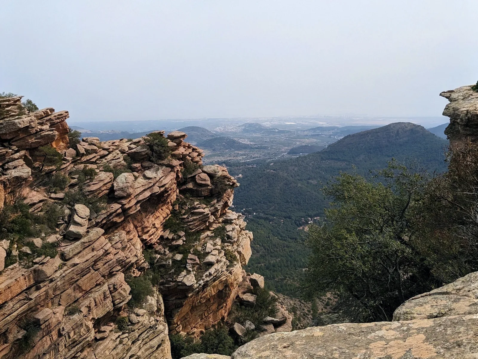
Going to the mountains from Valencia is surprisingly easy. I have visited several corners of the range over the years, and it makes for a perfect nature escape less than 30 km from the city. The Sierra Calderona rises directly behind the coastal plain north of Valencia, and while the lower foothills touch quiet towns like Náquera and Serra, the highlight of the range is the Mirador del Garbí - a dramatic sandstone balcony perched nearly 600 meters above sea level with views opening up across pine-covered valleys to the Mediterranean and Sagunto.
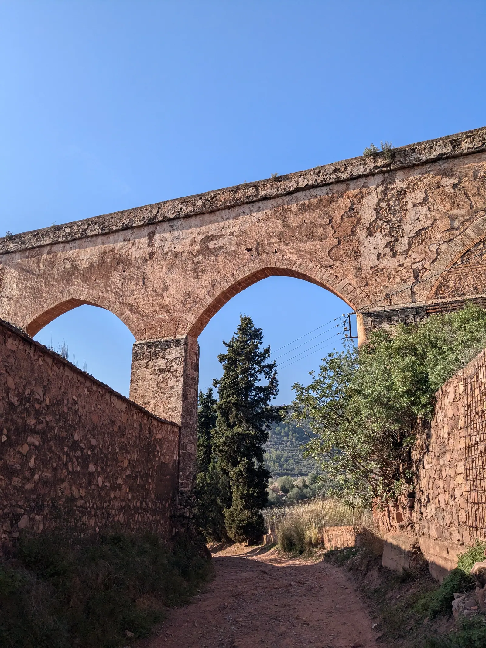
You can easily combine Garbí with wider trails around the Cartuja de Porta Coeli monastery, the red-rock ridges above Gilet, or really any other peaceful spot in nature across the range. For an in-depth breakdown of trailheads, parking areas, and scenic walks throughout the park, read my full Sierra Calderona hiking guide.
How to get there
- By car: Roughly a 35 to 40-minute drive north of Valencia into the hills above Náquera and Serra, continuing up the mountain road toward the Garbí trailhead.
- Public transit note: Metrovalencia Line 1 runs to Bétera, connecting with Metrobús line 133 to Serra village. However, hiking from the village up to Garbí adds several hours of steep climbing on foot, so a rental car is the easiest way to visit.
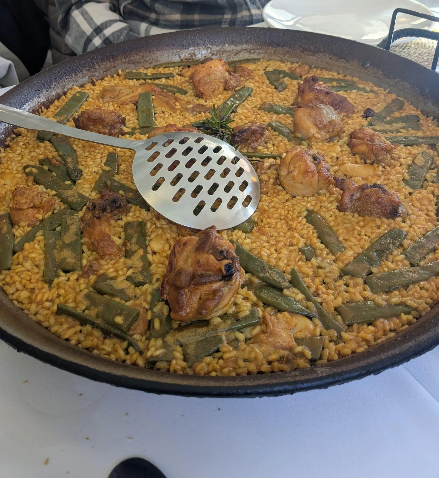
2. L’Albufera (El Palmar): Sunset Lagoon Boat Ride & Authentic Paella
Distance from Valencia: 18 km · Driving time: 20-25 minutes · Time on site: About 2-3 hours for a short visit; longer for lunch and sunset · Best for: Sunset boat rides, authentic Valencian paella, wetlands birdwatching · Transit: EMT Bus #24 or #25
L’Albufera is a protected wetland reserve and bird sanctuary sitting directly south of the city. The walking paths around Lago Devesa, the loop around Estany del Pujol, and the Ruta Botánica de l’Albufera are my personal favorite areas for quiet nature walks here, with peaceful coastal pine forests, sand dunes, and protected bird-nesting spots all around.
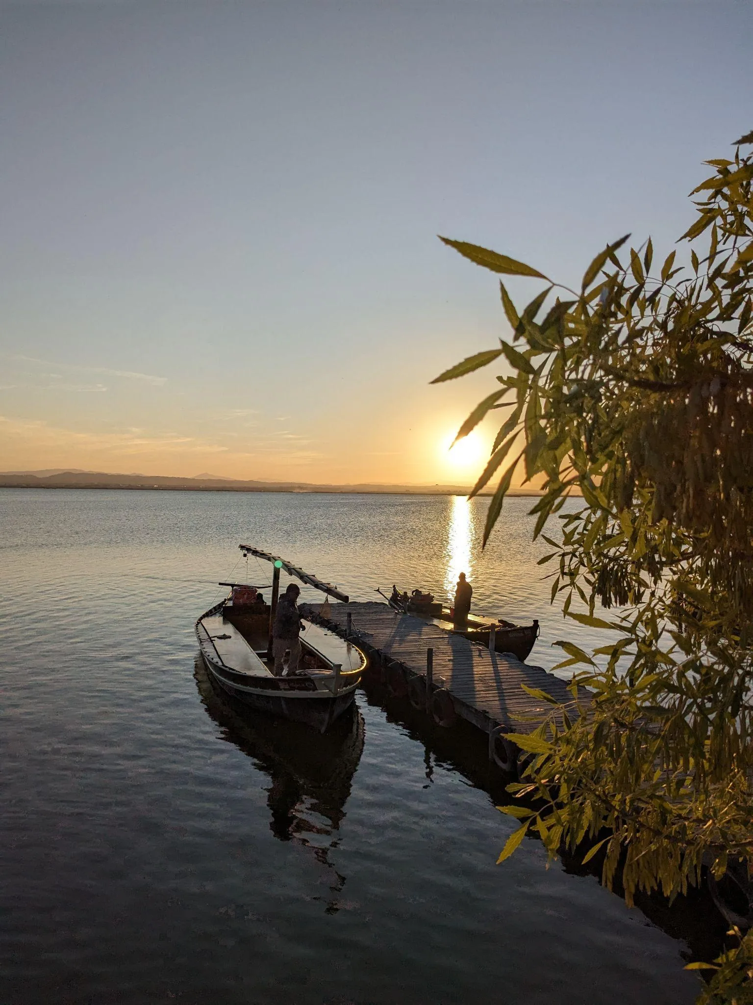
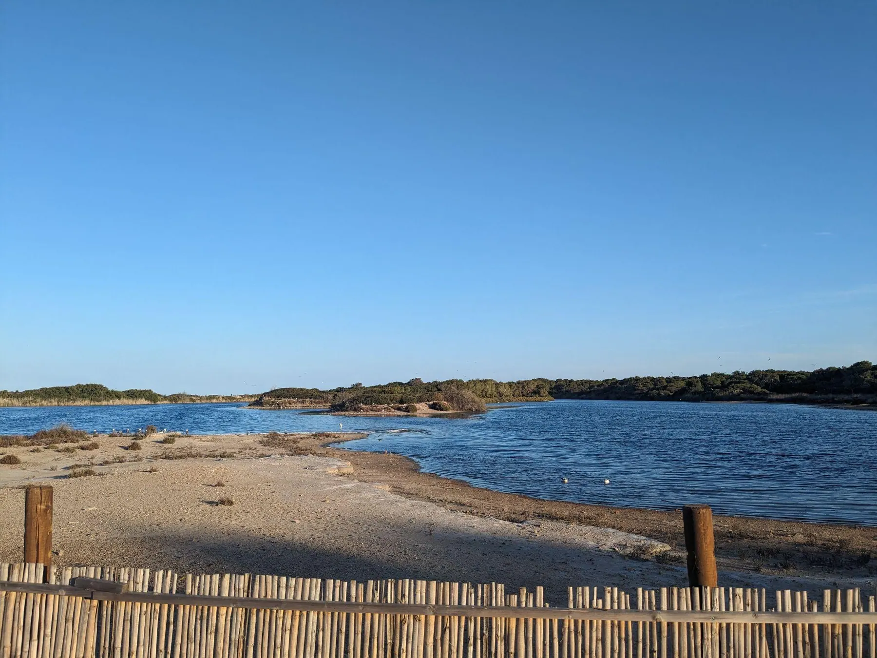
Heading down into El Palmar for traditional wood-fired paella is a huge part of the experience, as this canal-ringed village is where the dish originated. Just make sure to book a table in advance, especially on weekends when restaurants fill up quickly with local families. The Gola de Pujol viewpoint looks out over calm, glassy water from wooden jetties, though expect company in the late afternoon because it draws steady crowds at sundown.
The places mentioned here are spread out along the main road through the reserve rather than clustered around El Palmar. Mirador del Pujol (Gola de Pujol), for example, is a separate stop from the village. If you do not have a car, going by bike is also a good way to explore several of these spots in one outing; allow time to travel between them.
How to get there
- By city bus: Take the municipal Valencia EMT Bus #24 or #25 from central Valencia (Puerta del Mar). Buses run regularly throughout the day, take about 35 to 40 minutes, and cost €2.00 for a single ticket. Note that on weekends and public holidays, Line 24 stops at the village entrance roundabout rather than driving down into the central village lanes, so you will finish the trip with an easy five-minute walk to the boat piers and restaurants.
- By car: An easy 20 to 25-minute drive south of Valencia through the coastal pine forests toward El Saler and El Palmar.
3. Chelva & Peña Cortada: Roman Aqueduct Cliff Tunnels & The Water Route
Distance from Valencia: 68 km · Driving time: 50-55 minutes · Time on site: About 5-7 hours · Best for: Roman cliff tunnels, river canyon scenery, historic village quarters · Car required: Yes
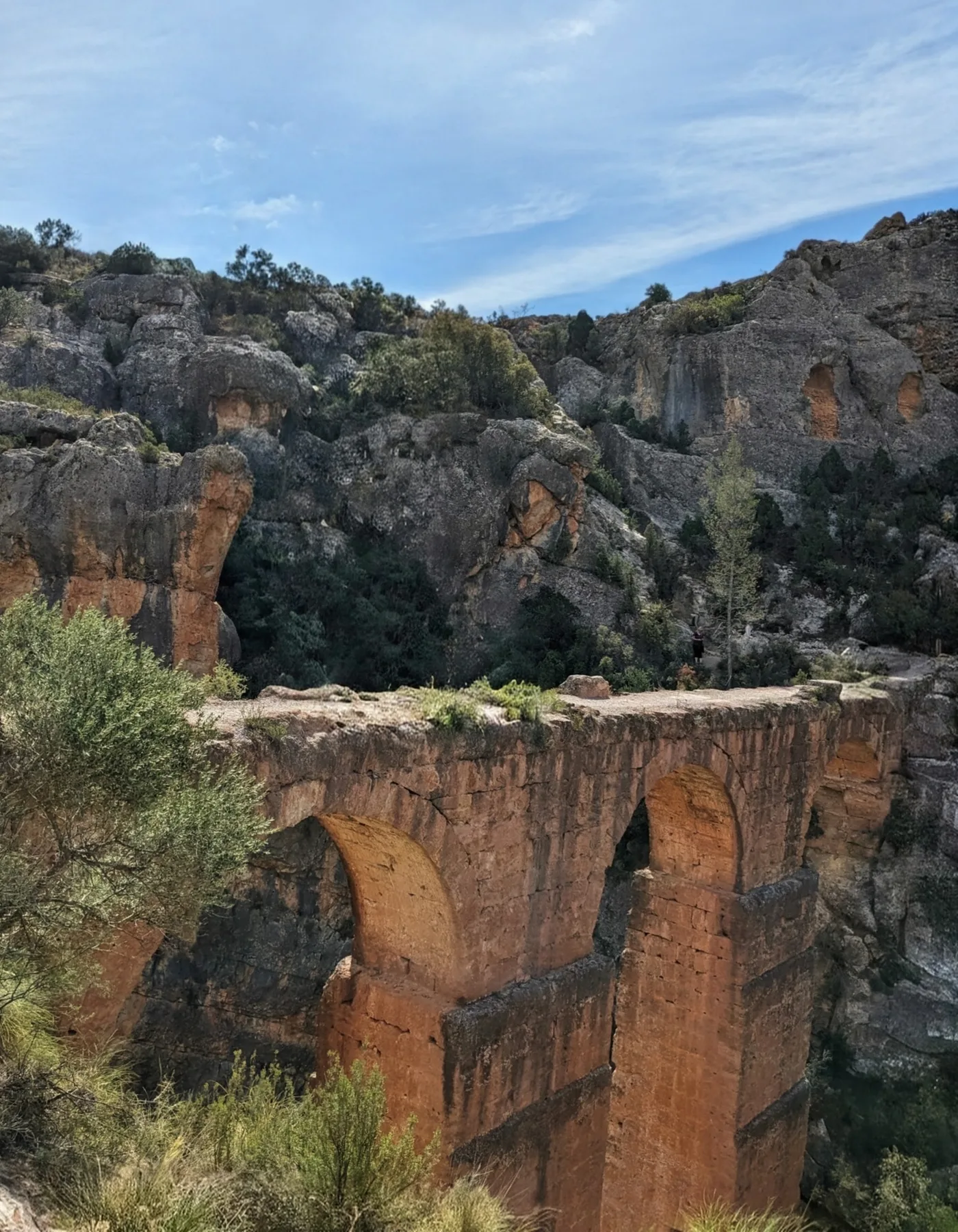
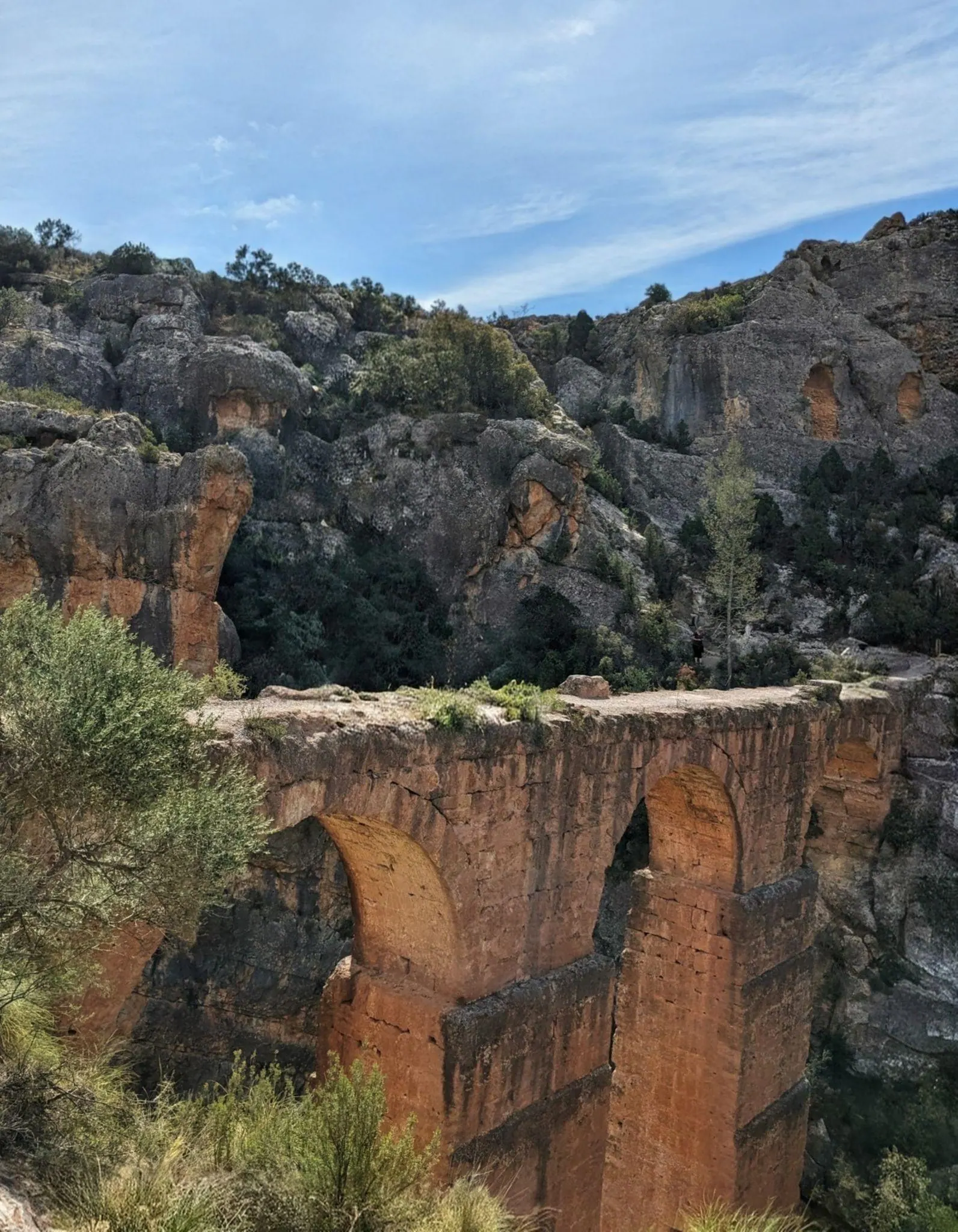
This is one of my personal favorite trail days near Valencia. While technically two connected trails - the Peña Cortada Roman aqueduct and Chelva’s Ruta del Agua (Water Route) - you can link both into a rewarding circular route. The path follows deep ravines before leading directly across a towering Roman aqueduct bridge and through tunnels cut into the rock high above the canyon floor, with open “windows” looking down into the gorge.
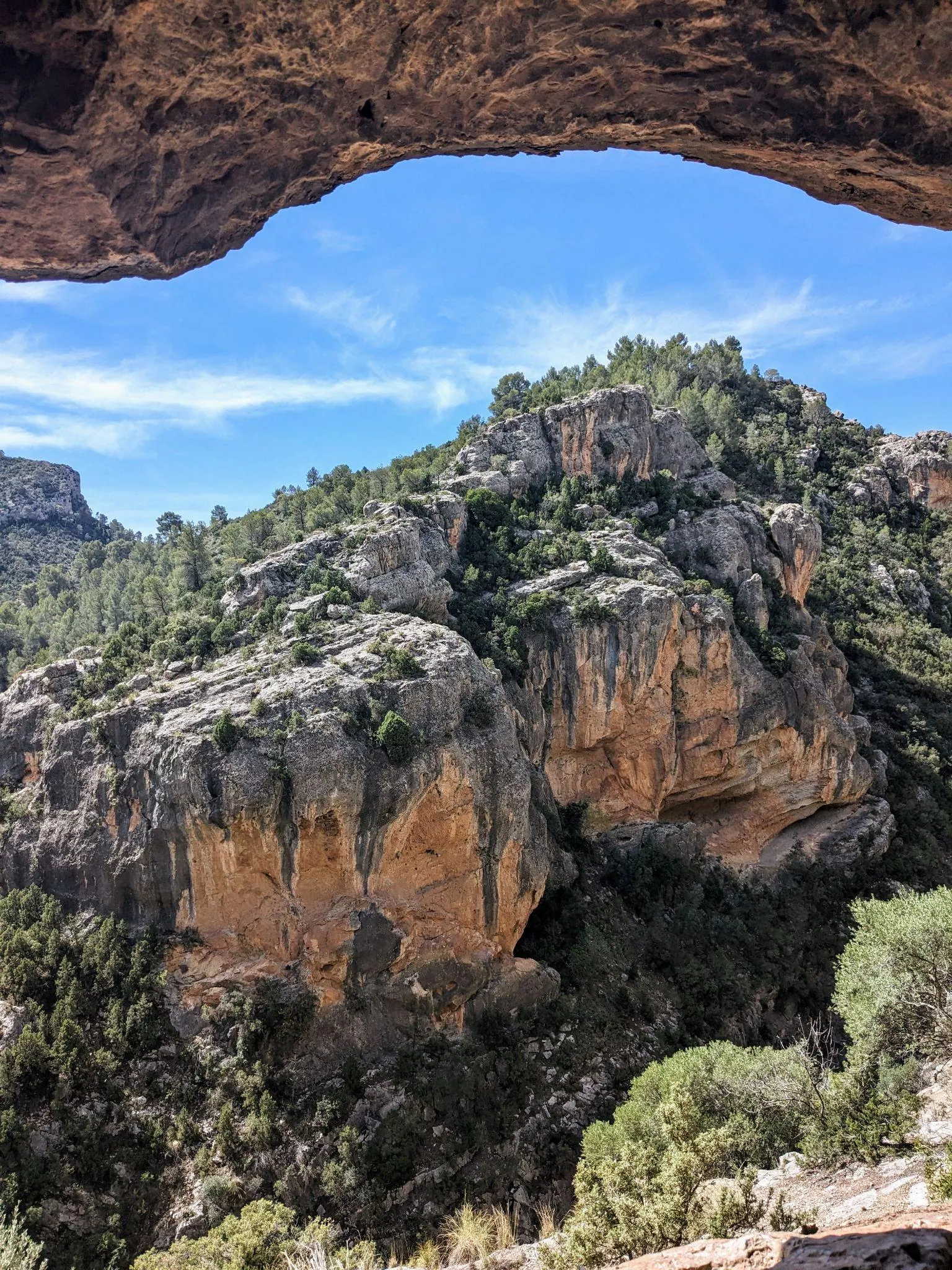
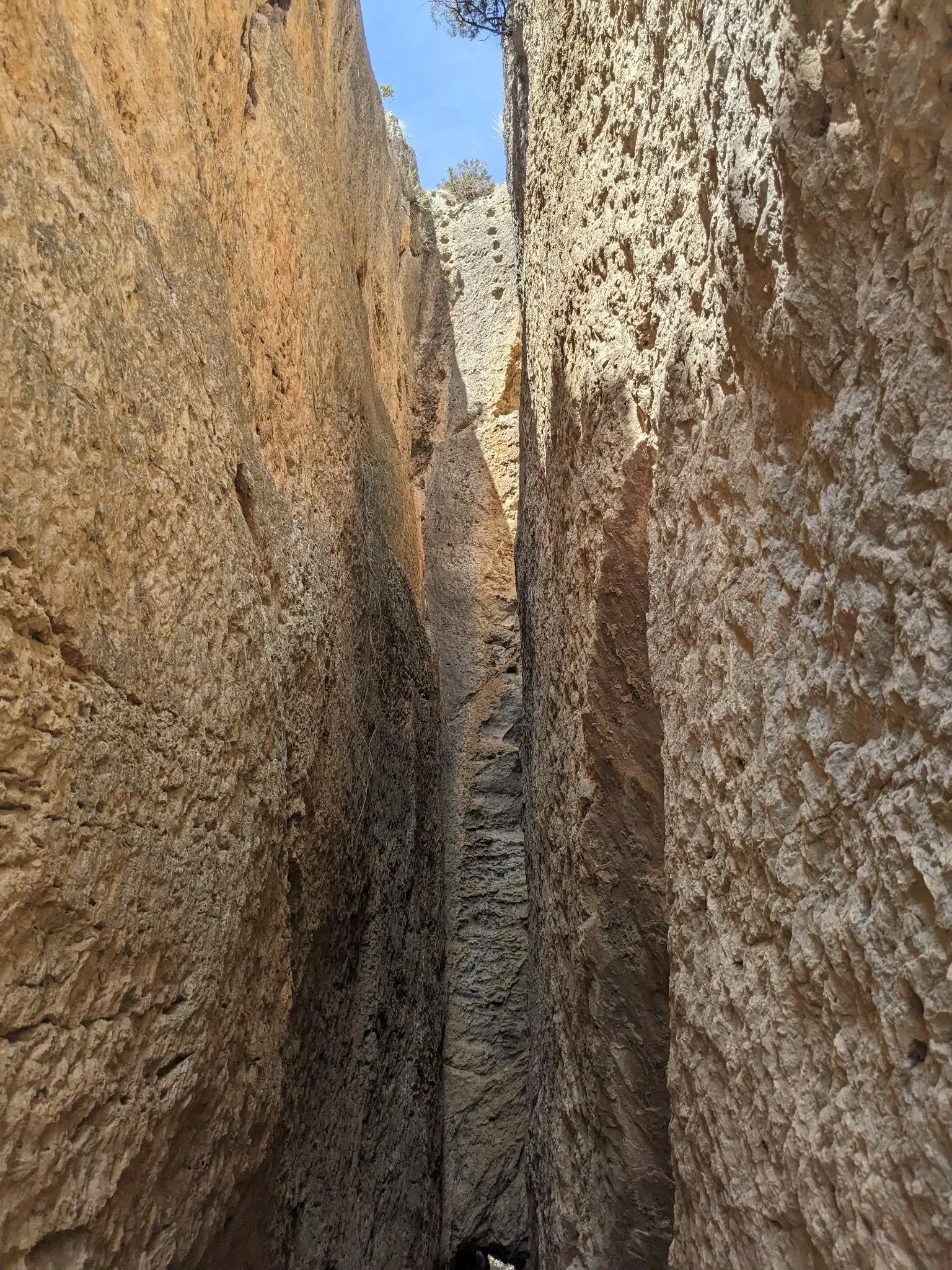
From there, the trail heads down along the river through the Ruta del Agua, passing quiet spots by the water, natural pools like La Playeta, and old canals that lead up into Chelva. The historic center is very pretty, and some of the streets are painted in bright blue in the Moorish quarter, giving the visit an extra visual bonus as you explore the town’s Christian, Jewish, and Moorish quarters.
How to get there
- By car: About 50 to 55 minutes northwest of Valencia into the mountain valley of Los Serranos. Trailheads for the aqueduct start from Calles or Chelva.
- Public transit note: Intercity bus service is limited and does not align well with trail start times, so driving is essential for a smooth visit.
4. Chulilla (Los Puentes Colgantes & Charco Azul): The Suspension Bridges Canyon
Distance from Valencia: 62 km · Driving time: 45-50 minutes · Time on site: About 4-6 hours · Best for: River gorge walking, suspension footbridges · Car required: Yes
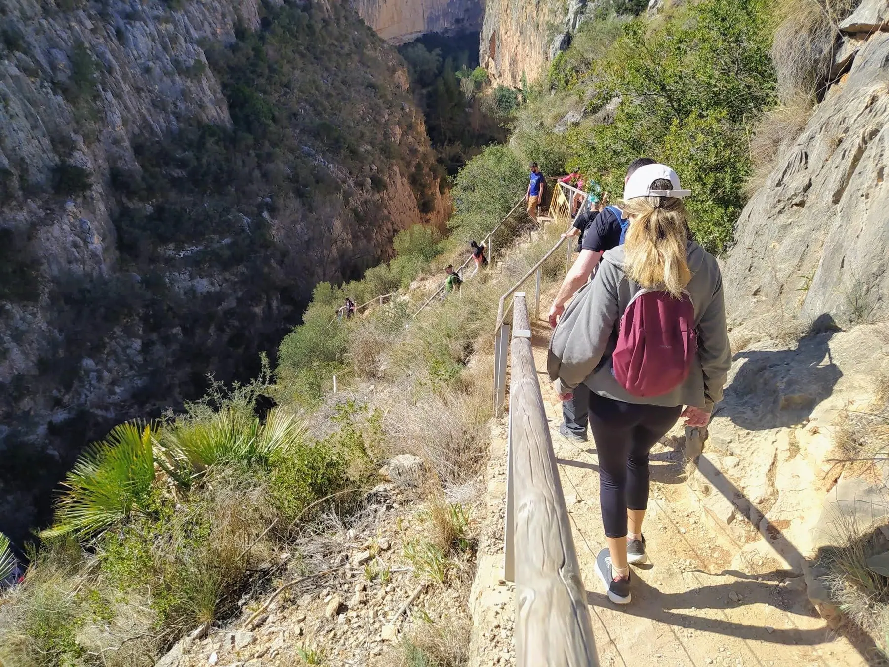
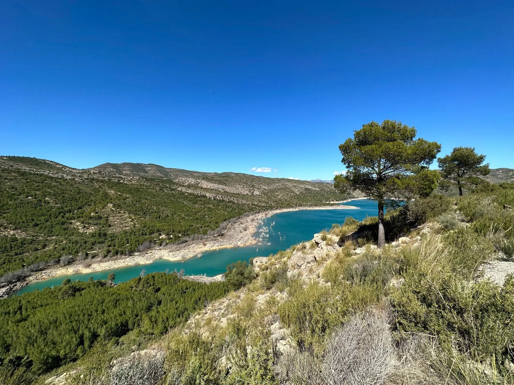
Chulilla is a classic Valencia day hike - the kind of trip that practically everyone who comes to live in the city for a while ends up doing. And for good reason: the suspension footbridges (puentes colgantes) hanging over the deep Turia river canyon make it truly memorable, and the sheer vertical gorge views are not bad either!
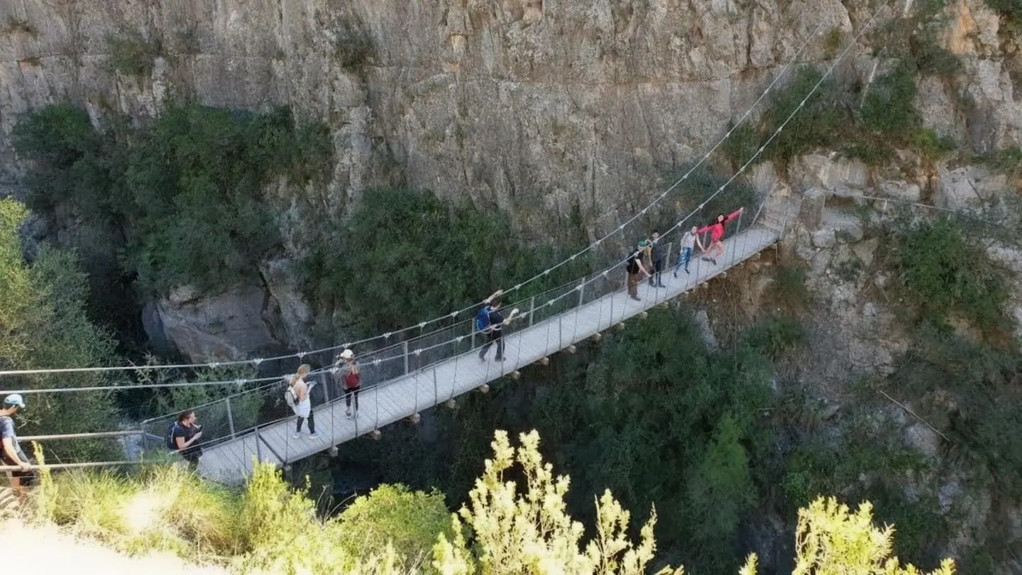
Downstream, an easy trail leads to Charco Azul, an enclosed river pool flanked by soaring cliffs where the Turia turns deep turquoise. Chulilla is also a world-famous rock climbing hub, so in winter you will see climbers tackling hundreds of bolted routes along the canyon walls.
How to get there
- By car: About 45 to 50 minutes drive northwest of Valencia directly to the suspension bridges parking (Parking Puentes Colgantes).
- Public transit note: Regional buses run irregularly between Valencia and Chulilla, making a day trip by public transit impractical. Renting a car for the day is the best way to go.
5. Puntal dels Llops (Olocau): Ancient Iberian Hilltop Watchtower
Distance from Valencia: 35 km · Driving time: 30-35 minutes · Time on site: About 2-3 hours · Best for: Pre-Roman archaeology, hilltop views, quiet village atmosphere · Car required: Recommended
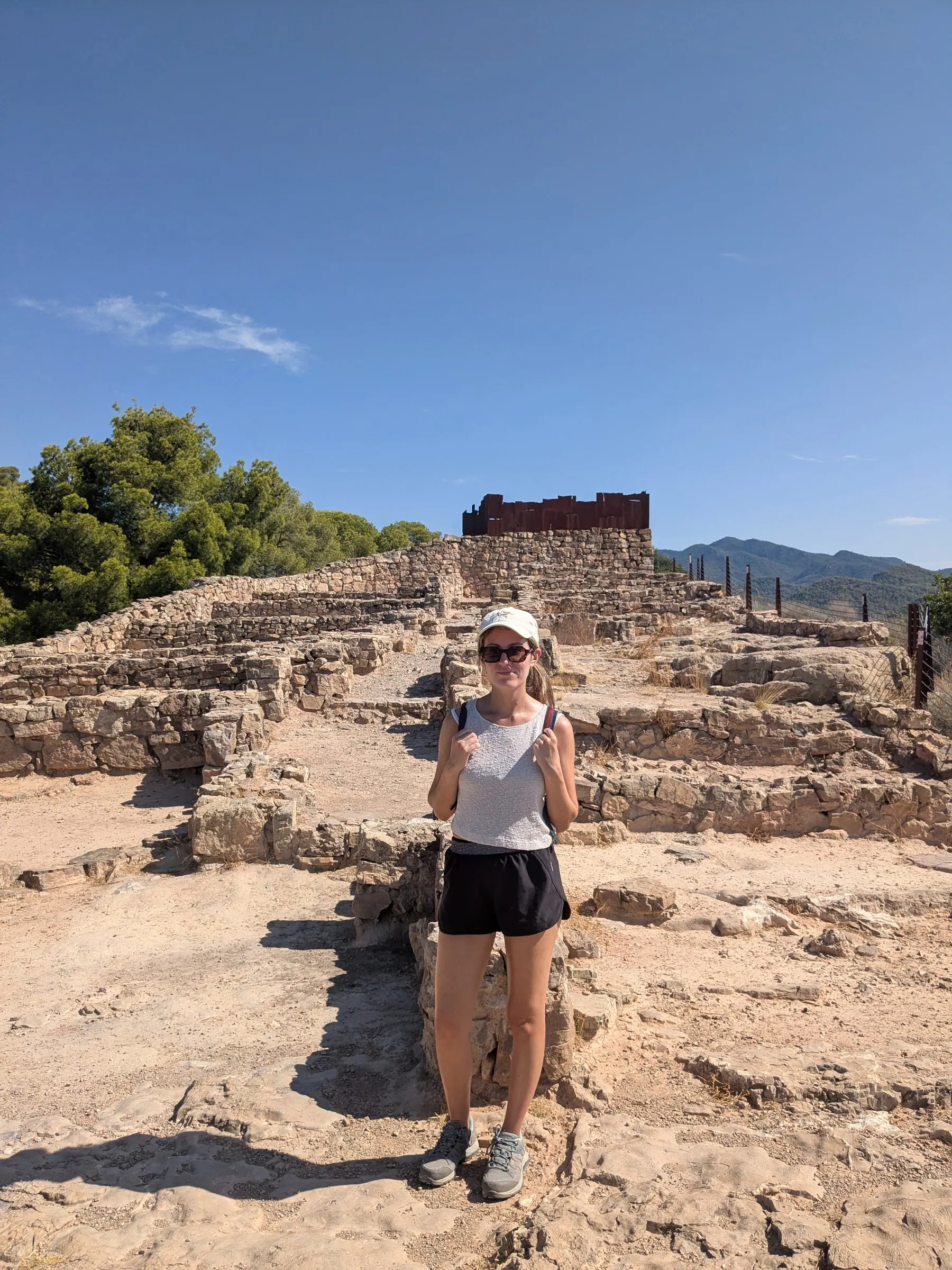
Puntal dels Llops is an ancient archaeological site sitting on Valencia’s doorstep. For anyone interested in early Mediterranean history, this fifth-century BC Iberian settlement offers well-preserved stone foundations and an expansive view across the orange groves of the Camp de Túria plain toward the sea.
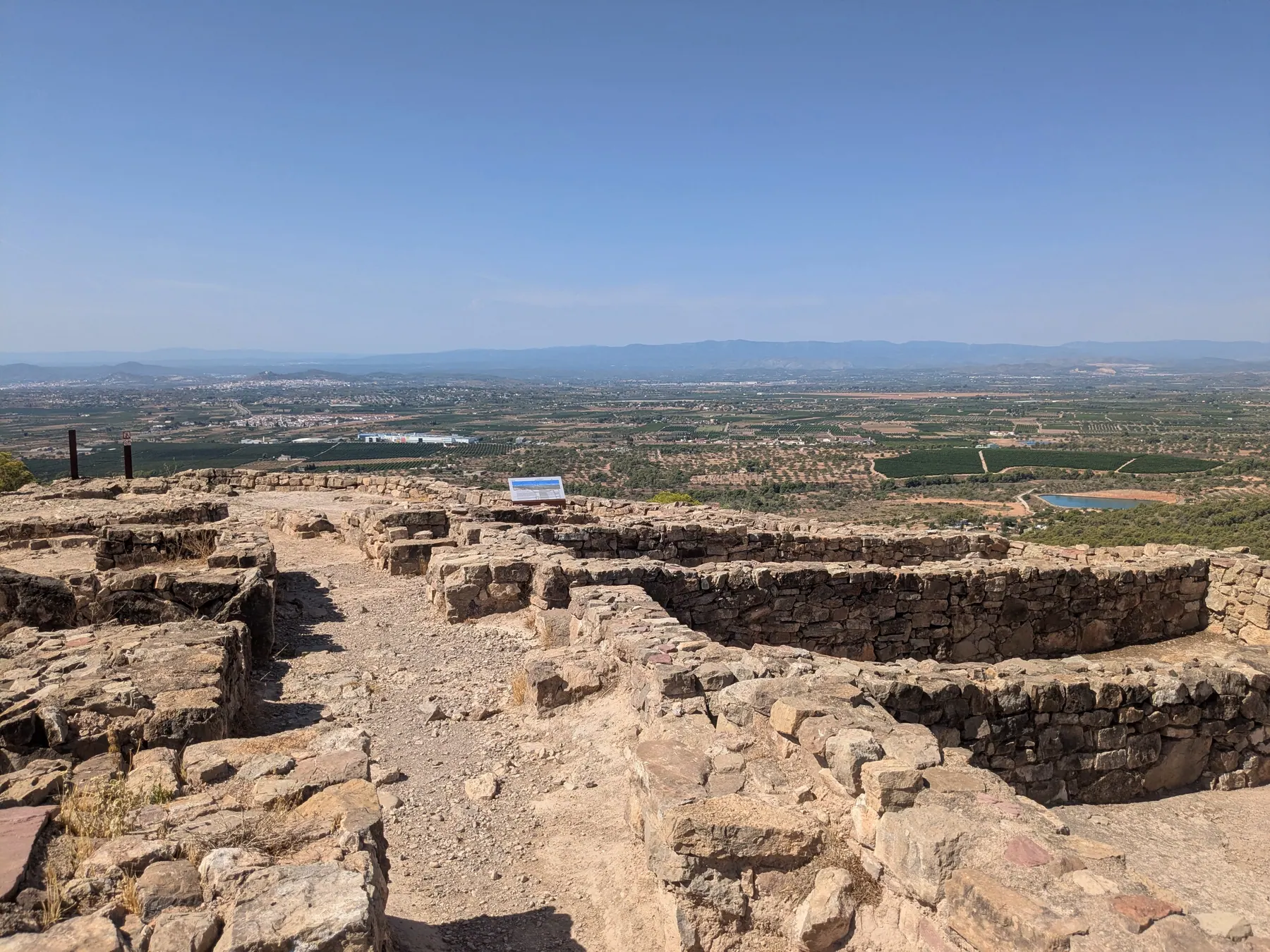
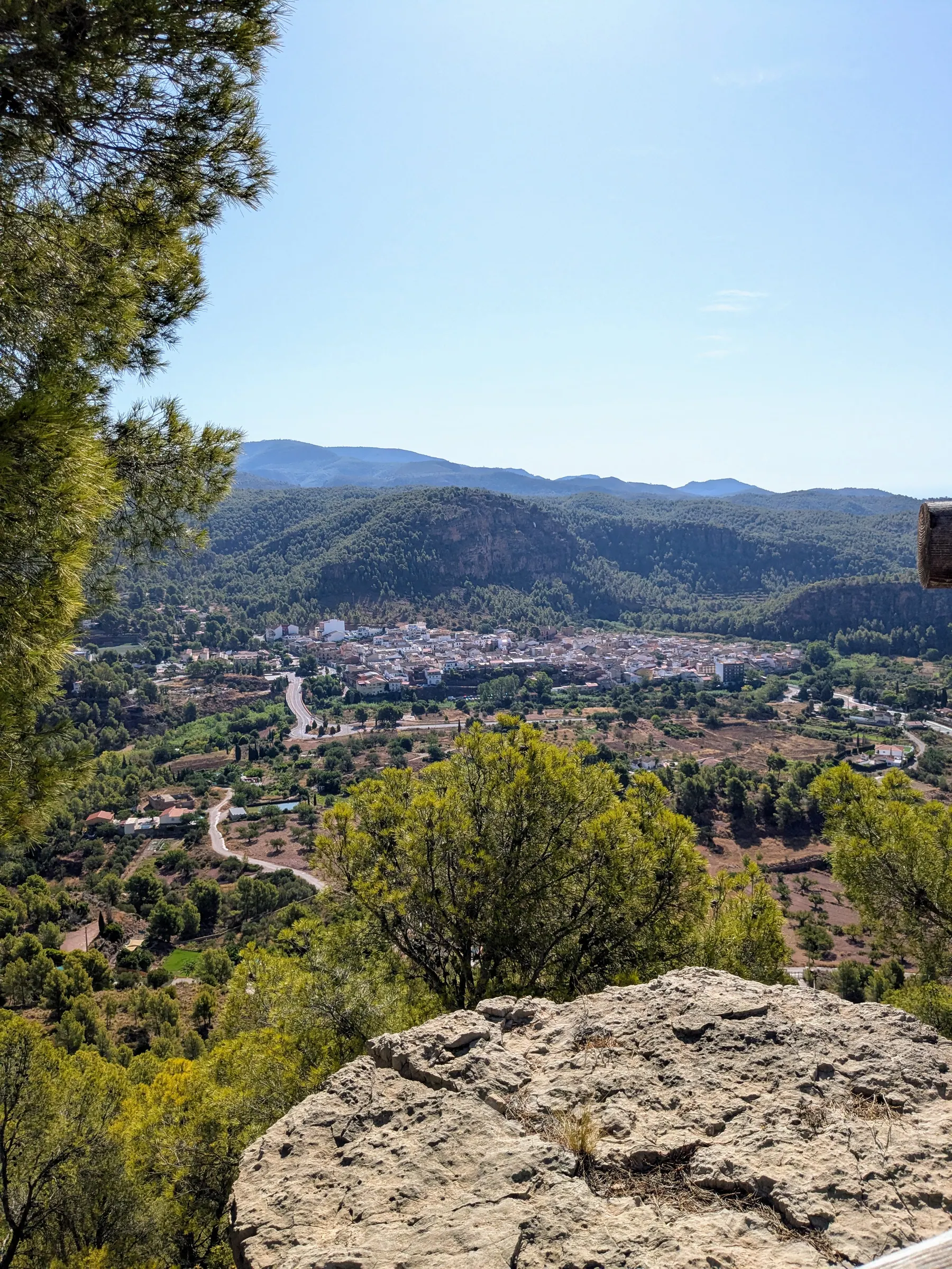
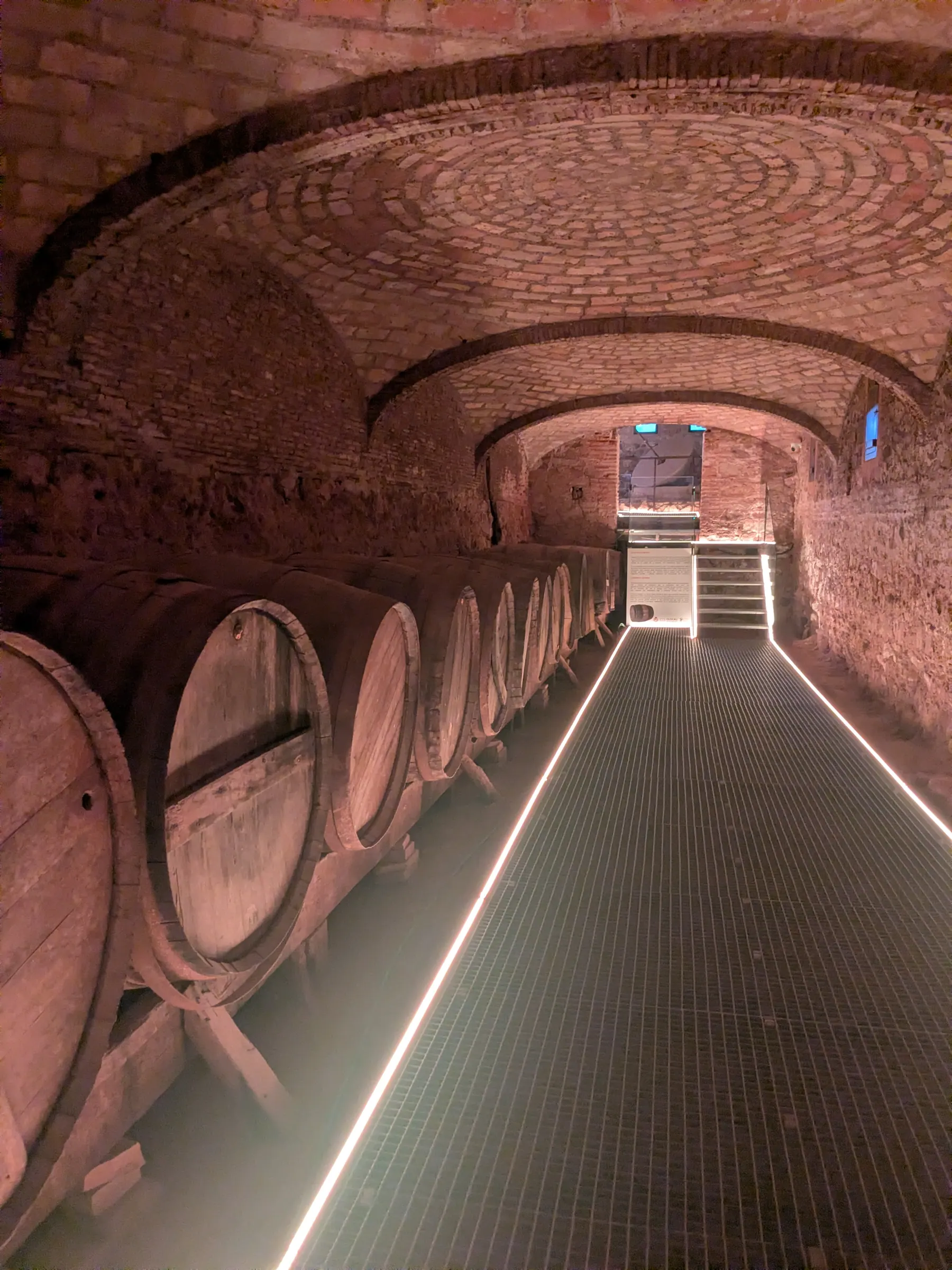
Sitting high on a rocky hill above the village of Olocau, the site was constructed by the Edetan Iberians as an early watchtower to monitor incoming mountain passes. You can see the original stone foundations of defensive towers and living quarters. Local archaeologists run free guided tours that explain how life functioned here before the Roman era. Down in the village, you can also visit the Casa de la Senyoria, which houses a small museum displaying artifacts found at the site alongside an old wine cellar. For details on booking and walking up from the village, see my Puntal dels Llops travel guide.
How to get there
- By car: About 30 to 35 minutes drive northwest of Valencia to the village of Olocau.
- Public transit note: While local bus connections exist from Bétera metro station, service is infrequent; a car is much quicker.
6. Xàtiva Castle: The Mountain Fortress (with Anna Waterfall as a 1-hour Add-on)
Distance from Valencia: 63 km · Driving time: 45-50 minutes · Time on site: About 4-6 hours (allow longer for Anna) · Best for: Massive medieval battlements, papal history, valley views · Transit: Direct Renfe C-2 train
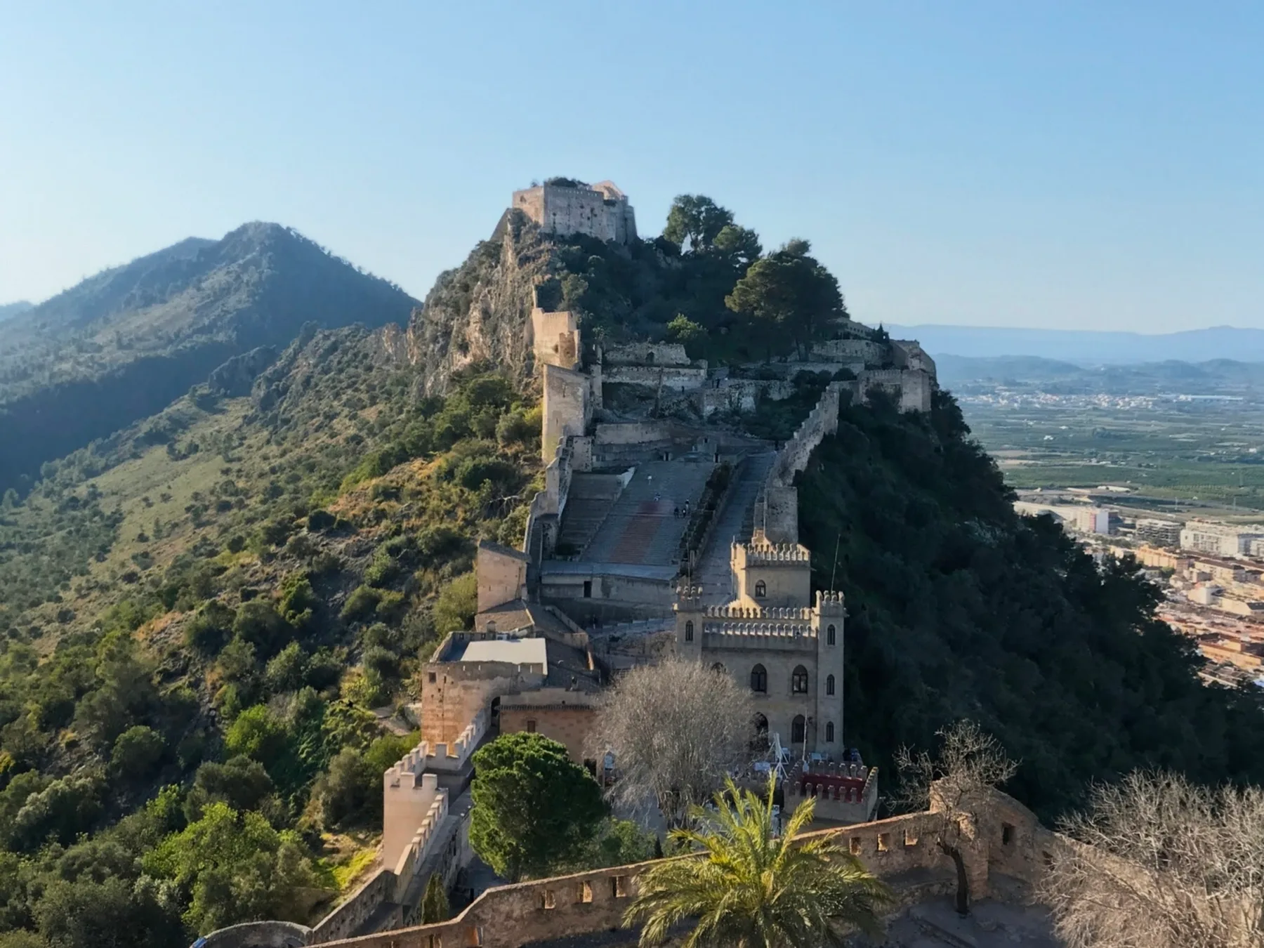
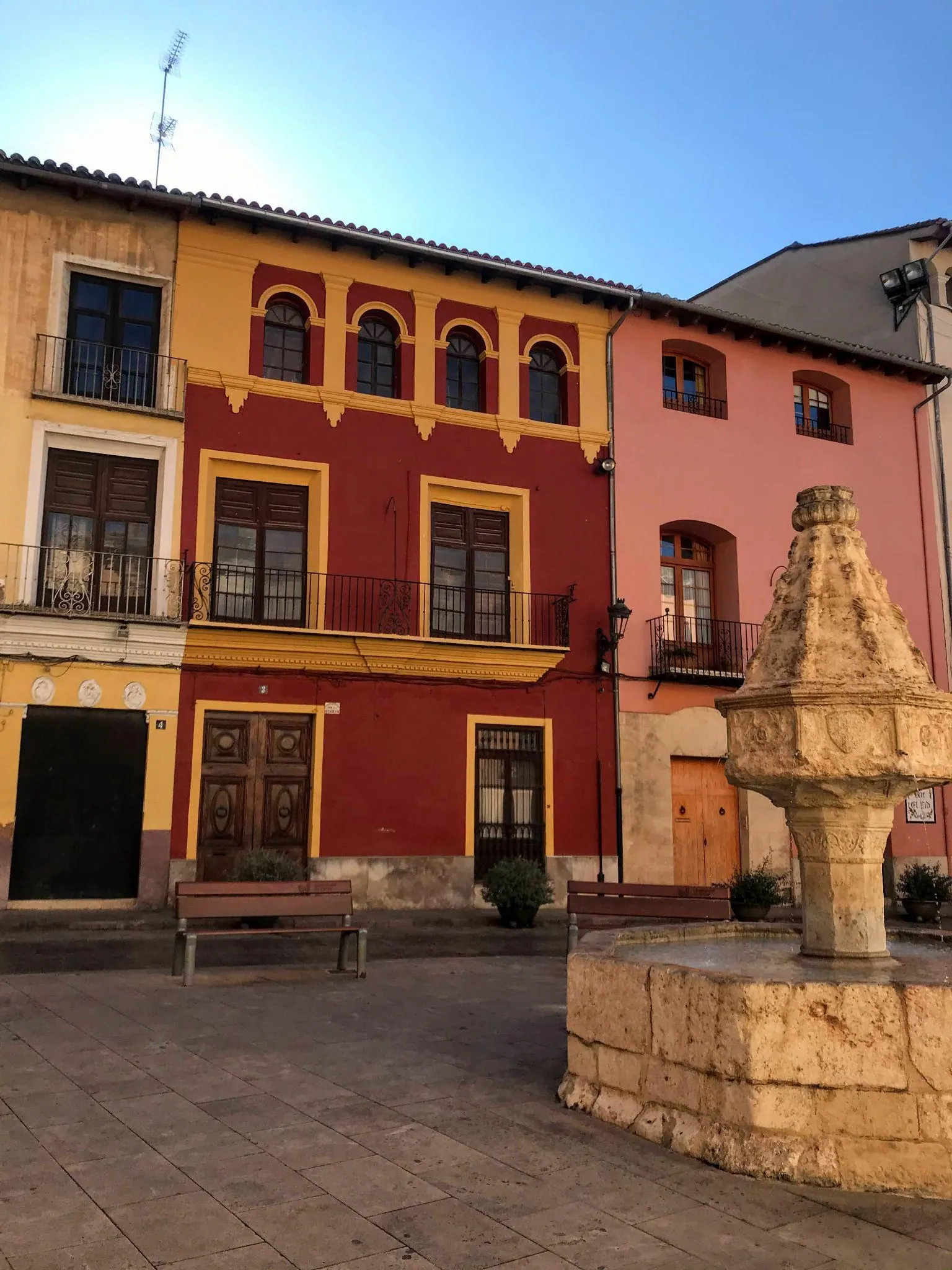
Xàtiva is dominated by a twin-peaked fortress perched along a high limestone crest above the town. What makes it memorable is walking the defensive stone walls that link Castell Menor and Castell Major, with uninterrupted views across the surrounding valley. The town down below is really nice to wander through as well, with leafy plazas and a rich history tied to the famous Borgia family.
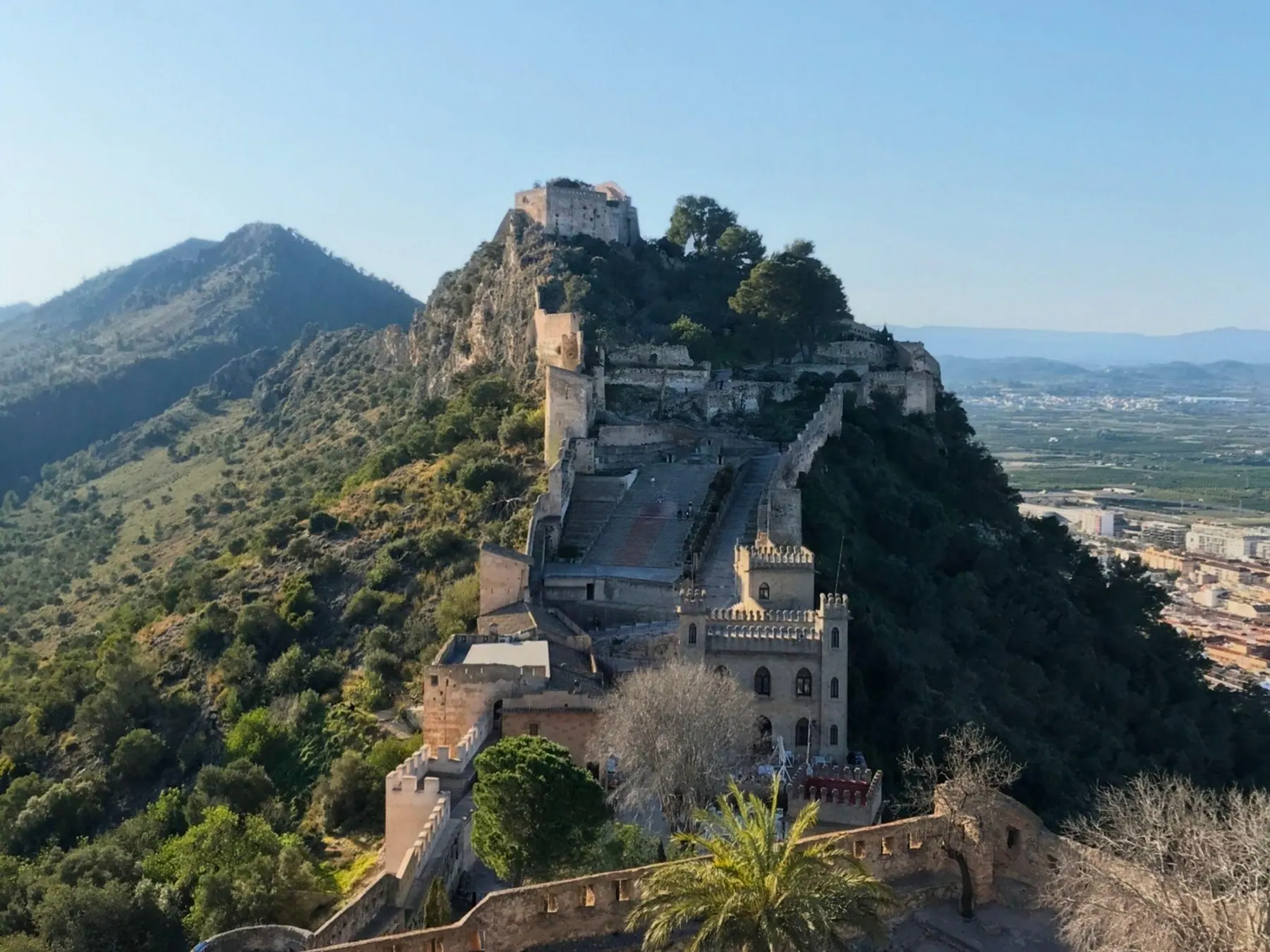
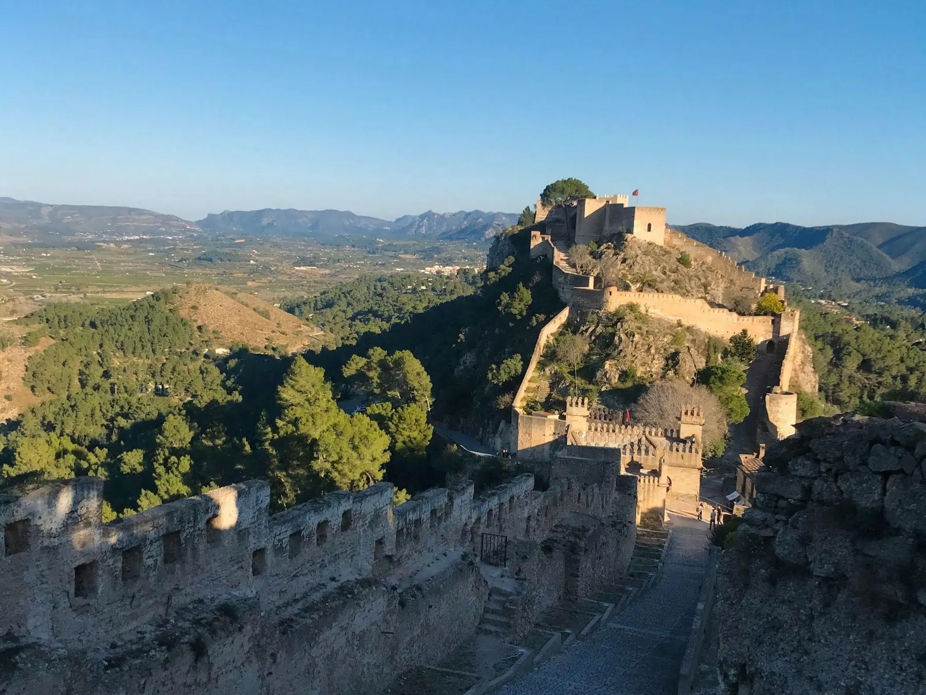
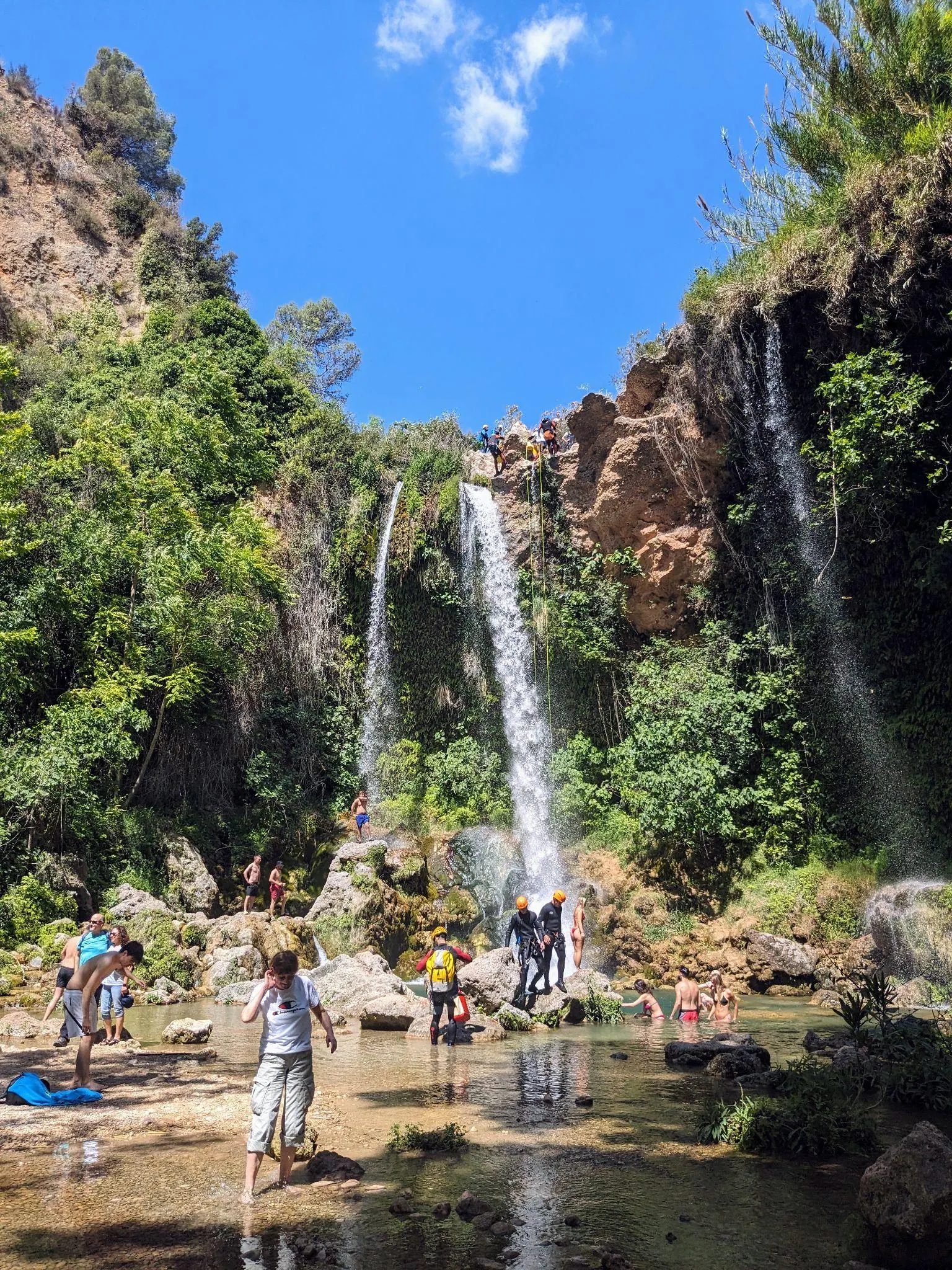
If you arrive by train, be ready to walk uphill from the station through the town to reach the castle gate (or catch the small tourist road shuttle if you prefer to save your legs). Xàtiva itself works without a car, but you need one for the optional trip to Anna, about a 15-minute drive away. Allow about an hour there for a quick stop at the Gorgo de la Escalera, a canyon waterfall that drops into a clear natural pool.
If you have more time, the Ruta de las Tres Cascadas de Anna is an absolute gem. This riverside walk takes you past three waterfalls; allow about 1.5-2 hours for the trail itself, in addition to the drive from Xàtiva. It is a longer outing than the quick waterfall stop, so check the route’s access information before you go.
How to get there
- By train: Take the direct Renfe Cercanías line C-2 from Valencia Estació del Nord straight to Xàtiva station. Trains depart every 30 minutes, take 45 to 50 minutes, and cost under €10 round trip. From the station, walk 15 minutes through the historic center to reach the foot of the castle road.
- By car: About 45 to 50 minutes drive south of Valencia to the lower town.
7. Bocairent & Pou Clar: Stone Village, Moorish Cliff Caves & Limestone Pools Combo
Distance from Valencia: 85-95 km · Driving time: 1 hr 10 mins · Time on site: About 5-7 hours · Best for: Moorish cliff caves, rock-carved bullring, freshwater swimming · Car required: Yes
Bocairent is a stone hill town set above a gorge, with narrow lanes that are worth exploring on their own. But do not stop at the historic center: also visit the Covetes dels Moros (Caves of the Moors). Be ready to do some climbing inside: I did it myself, and you need to be reasonably agile to crawl and climb between the connected rock rooms. The views looking back at the town and the gorge from inside and around the cliff are great too - it actually gave me Matera in Italy vibes! Another unique stop right in town is the bullring carved into the rock (Plaza de Toros), which was cut into the hillside in 1843 and is the oldest in the region.
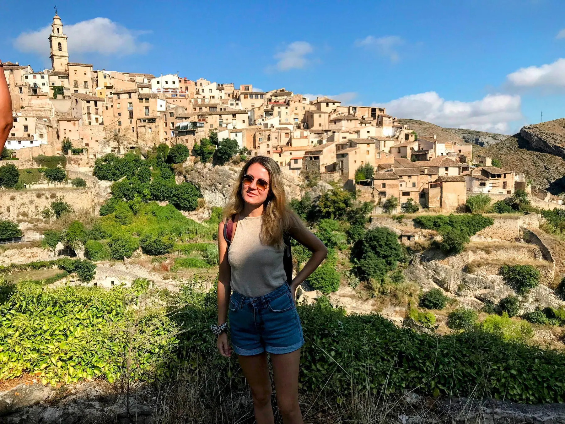
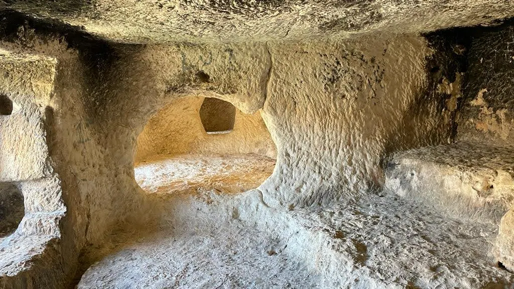
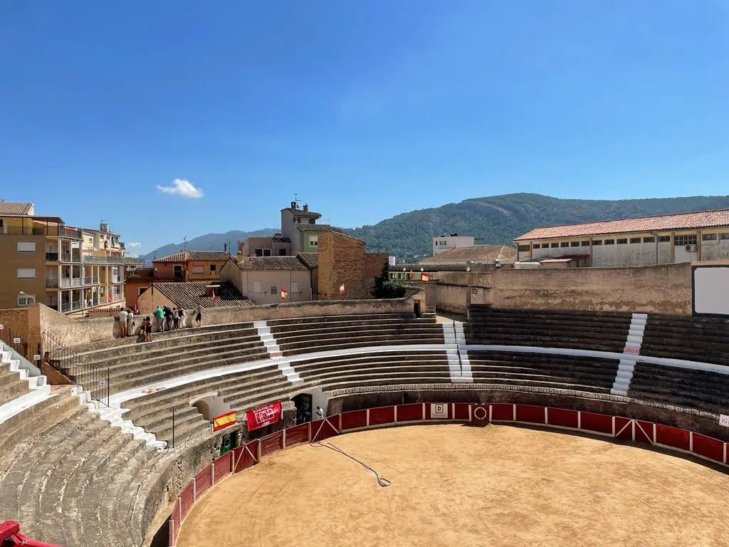
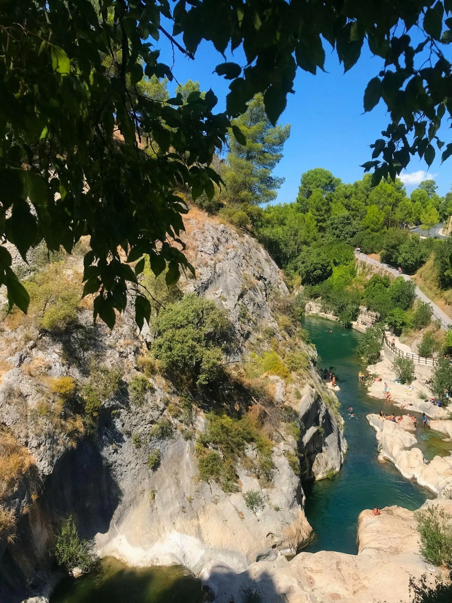
Just a few kilometers away outside Ontinyent, Pou Clar is a freshwater swimming spot where the Clariano River forms clear pools between smooth rocks. The cold mountain spring water is crisp on hot summer days, and in cooler months it provides a peaceful picnic pause right by the stream.
Important — Summer reservation required for Pou Clar: During July and August, access to the Pou Clar natural pools requires a mandatory advance reservation via the Ontinyent municipal booking portal to protect the river habitat and control visitor capacity. Without a confirmed QR code reservation, staff at the entrance checkpoint will turn vehicles away. Outside July and August, access is free and unrestricted.
How to get there
- By car: About 1 hour 10 minutes drive south of Valencia into the inland valleys. Pou Clar sits right off the main road roughly 10 minutes before reaching Bocairent. (In July and August, make sure to have your online reservation confirmation ready when arriving at the paraje parking area).
8. Vía Verde del Mar (Benicàssim–Oropesa): Coastal Cliff Railway Bike Path
Distance from Valencia: 86 km · Driving time: 55 mins to 1 hour · Time on site: About 3-5 hours · Best for: Coastal cycling, car-free walking, sea cliff views, secluded coves · Transit: Renfe C-6 train
The Vía Verde del Mar is a real nature reset place, great for anyone who likes to go cycling or walking along the sea. Converted from the historic coastal railway line between Benicàssim and Oropesa del Mar, this completely car-free 5.7 km path follows the rugged shoreline past pine-covered bluffs, rocky coves, and open sea vistas.
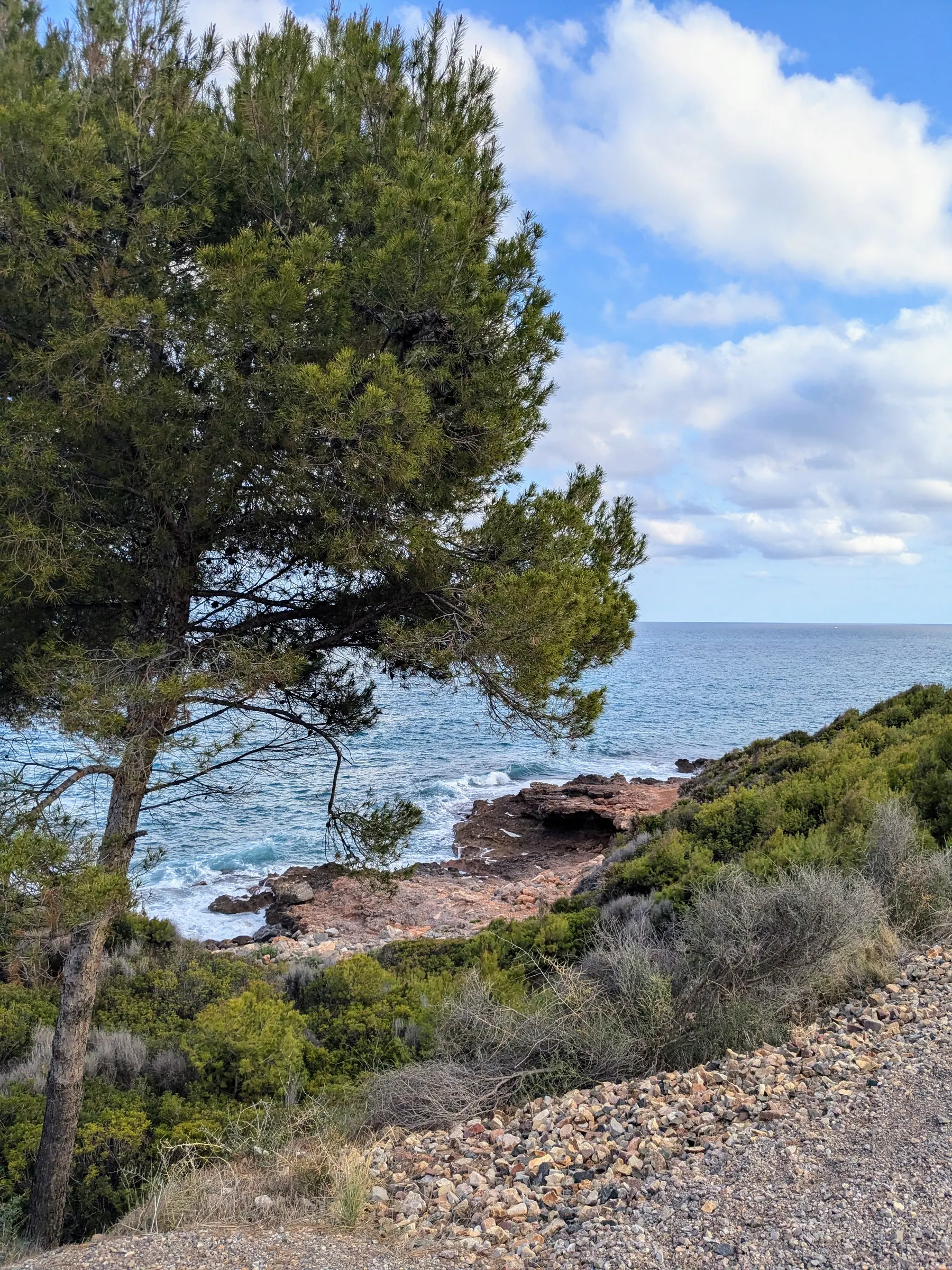
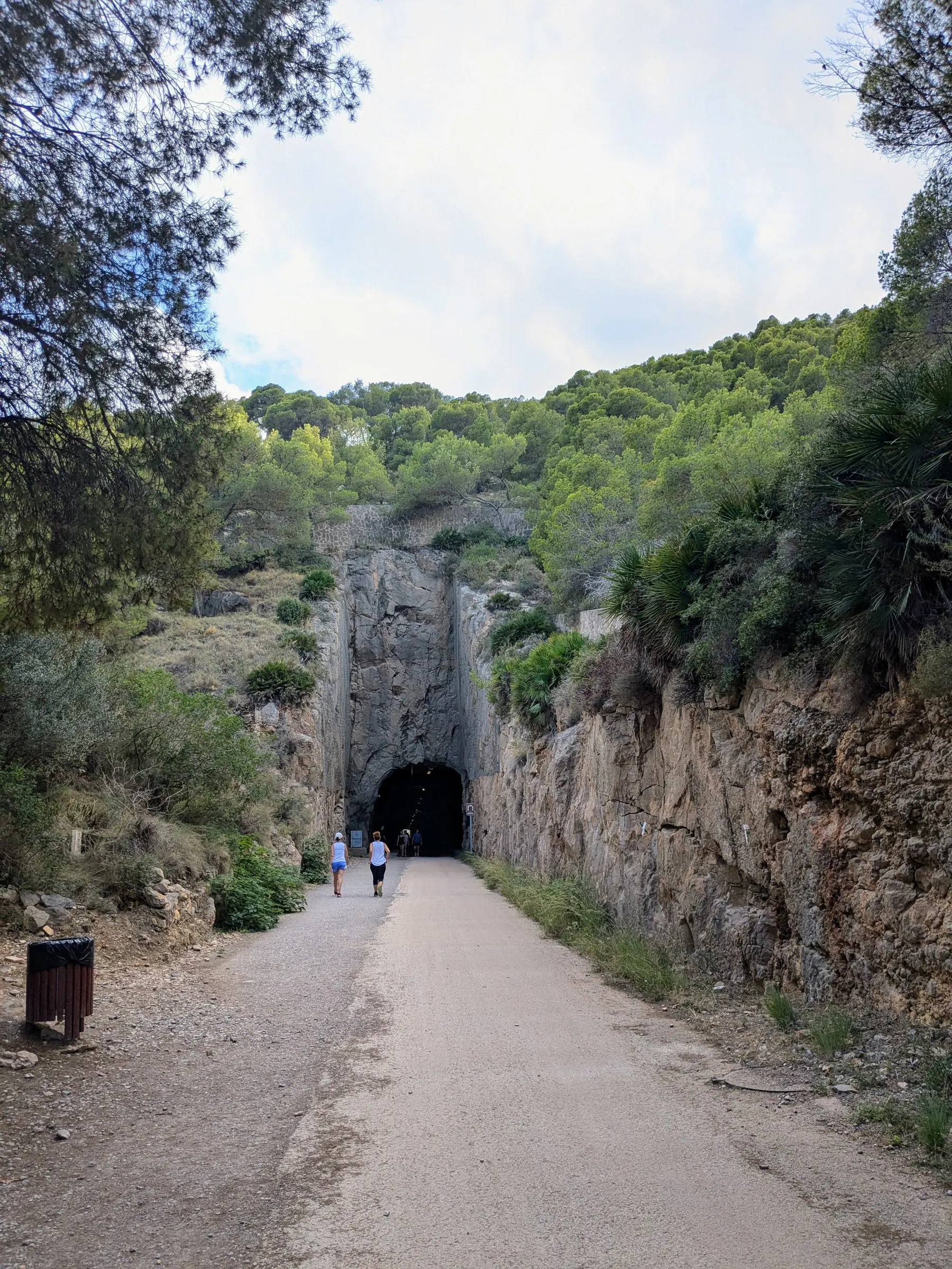
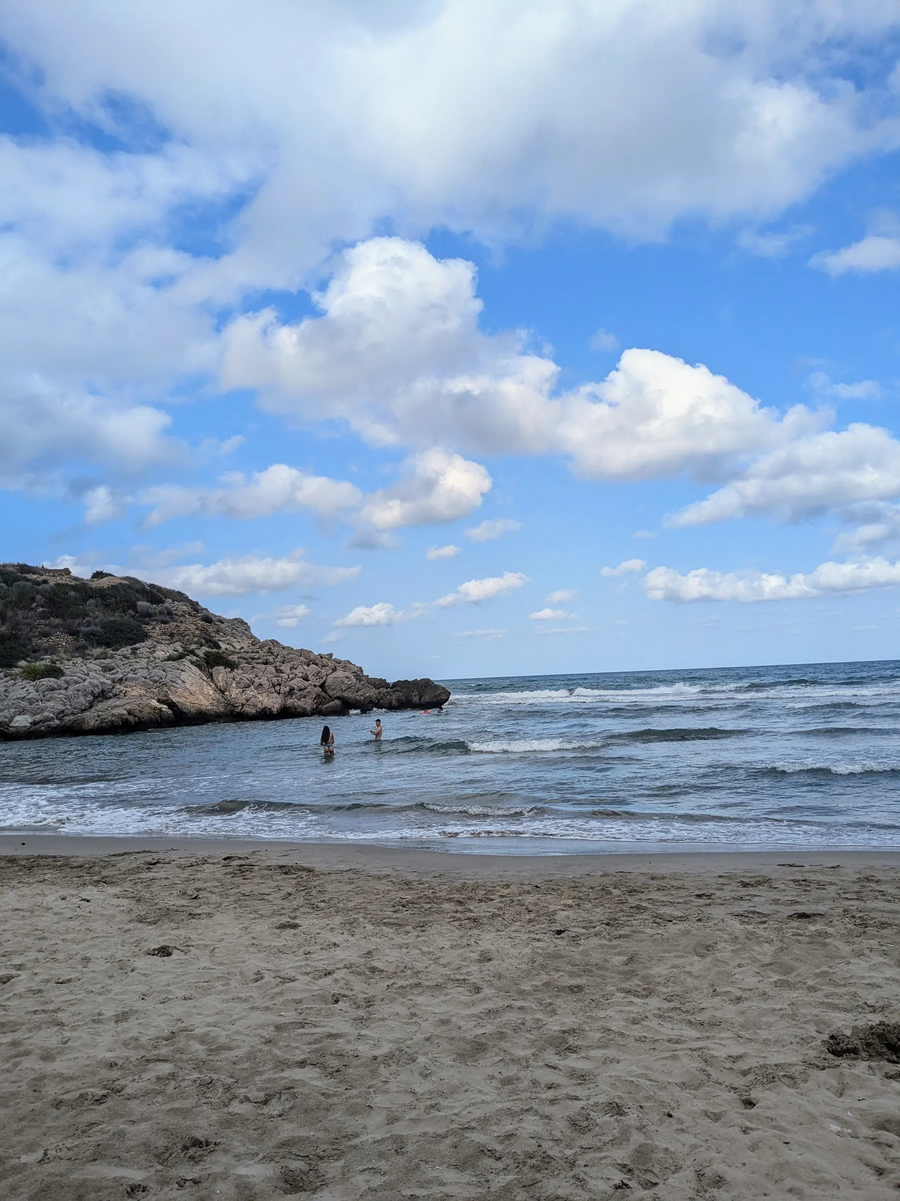
You pass through a 600-meter lit railway tunnel and past 16th-century pirate watchtowers. If you go in summer, start early and stop for a swim at one of the rocky coves (calas) or the sandy Cala Retor; avoid walking the exposed path in the midday heat. In colder months, it is a relaxing coastal stroll in the winter sun. Read my complete Vía Verde del Mar guide for route details.
How to get there
- By train: Direct Renfe Regional and Cercanías C-6 trains run frequently from Valencia Estació del Nord to Benicàssim station in about 50 to 65 minutes. You can rent a bicycle near the station and cycle five minutes down to the trailhead.
- By car: About 55 minutes to an hour drive north along the coast toward Benicàssim.
9. Peñíscola & Sierra de Irta: Knights Templar Sea Castle & Wild Coastal Headland
Distance from Valencia: 142 km · Driving time: 1 hr 25 mins · Time on site: About 5-7 hours · Best for: Historic sea fortresses, famous movie set, undeveloped coastal headlands · Car required: Yes
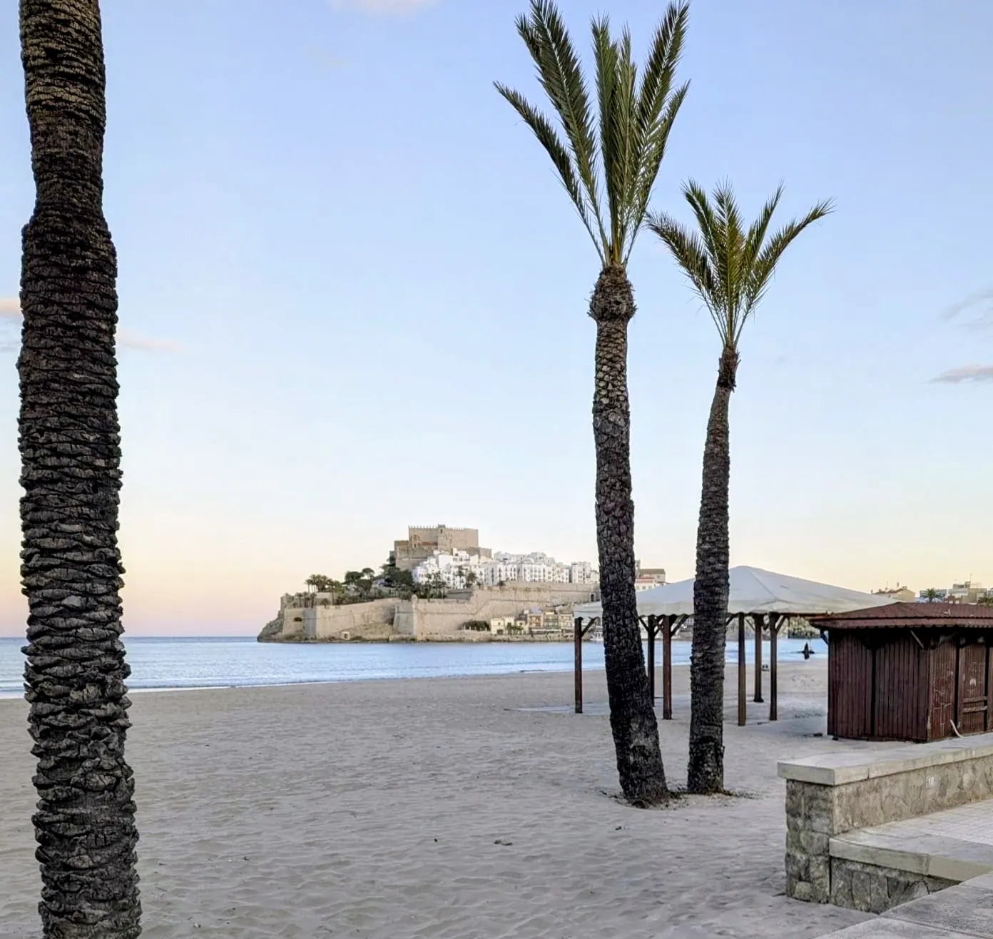
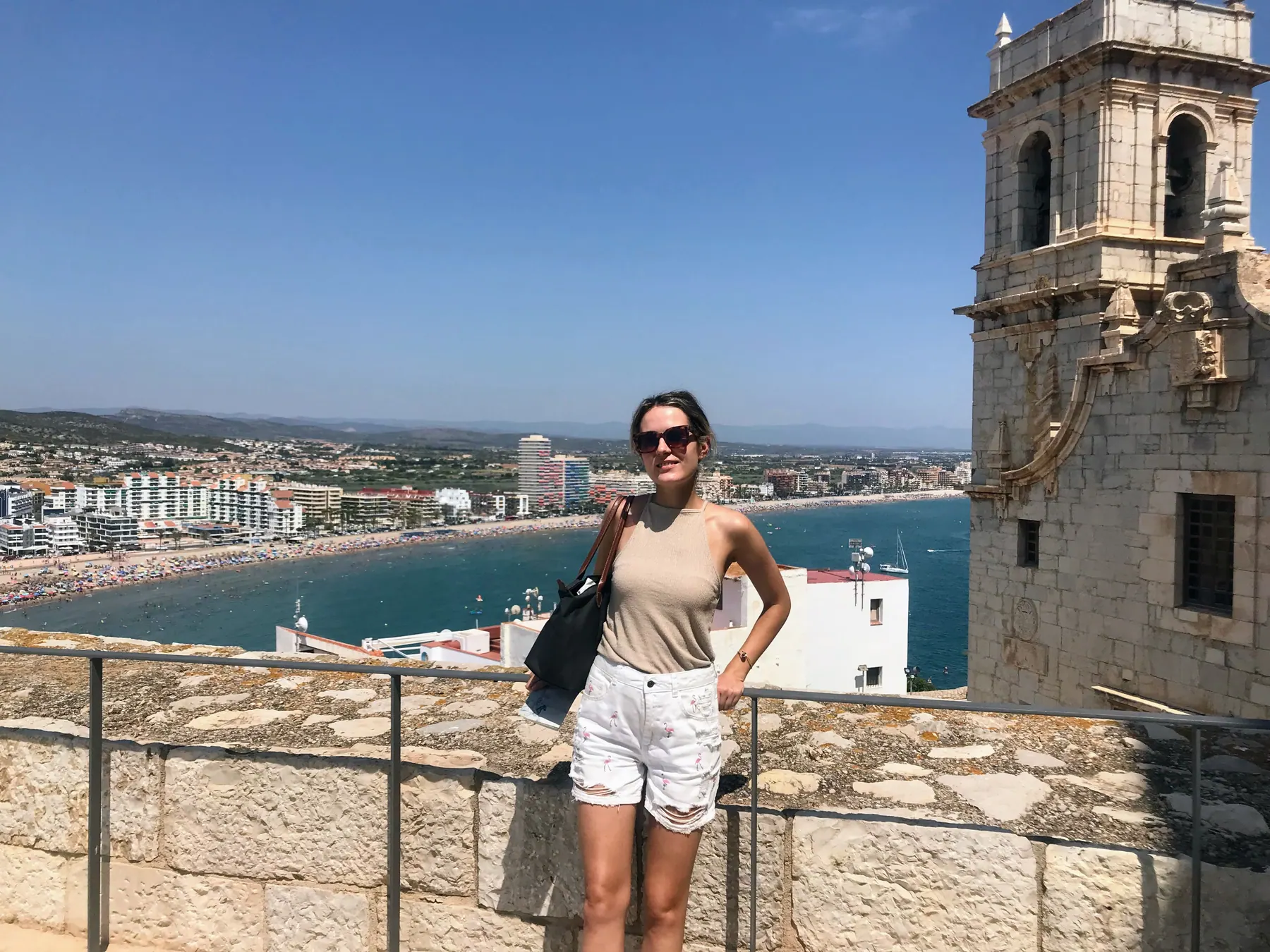
Peñíscola is a well-deserved place to visit from Valencia. The whitewashed walled town juts into the open Mediterranean on a rocky headland and can easily be explored without rush, wandering its cobblestone lanes, old city walls, and the 13th-century Knights Templar fortress where Papa Luna once resided. Peñíscola was also a filming location for films such as El Cid and Calabuch, as well as the TV series Game of Thrones.
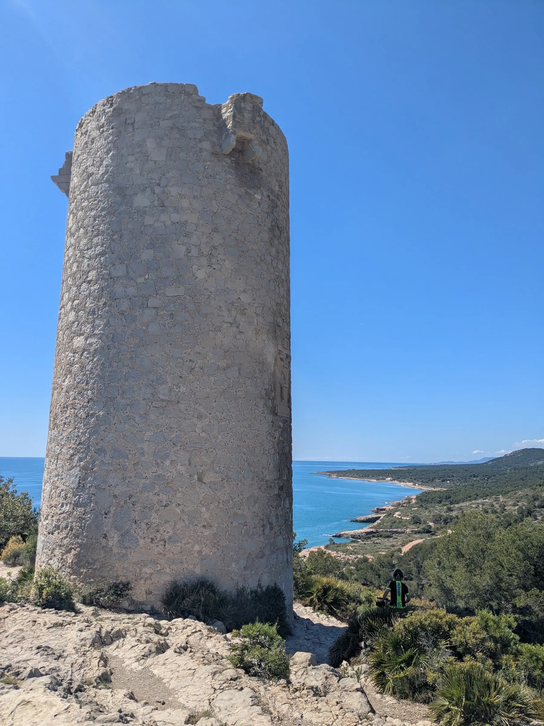
If you have extra time and a car, you can also do the coastal walk just next to the town inside the Sierra de Irta Natural Park. This is one of the last undeveloped stretches of the Mediterranean coast in eastern Spain, featuring unpaved tracks, dramatic sea cliffs, the solitary Torre Badum watchtower, and quiet pebble beaches. See my Peñíscola and Sierra de Irta guide for the full itinerary.
How to get there
- By car: About 1 hour 25 minutes drive north along the coastal motorway directly to Peñíscola.
- Public transit note: While trains run from Valencia to the Benicarló-Peñíscola station (7 km outside town), reaching the remote trails and coves of the Sierra de Irta park requires a car.
10. Dénia: Hilltop Castle, Port Gastronomy & Cova Tallada Coastal Trail
Distance from Valencia: 105 km · Driving time: 1 hr 10 mins · Time on site: About 4-6 hours · Best for: Hilltop castle views, port seafood dining, Cova Tallada sea cave trail · Car required: No for town; local bus available for cave trail
Dénia is a strong choice to visit near Alicante, while still being relatively close to Valencia. Going by bus is possible too, and they run frequently from Valencia’s central bus station. The town has a pretty centre with an active port area, and a walk up to the upper city to the Castle rewards you with beautiful views across the marina and the Mediterranean. When it comes to dining, the gastronomy with its seafood variety and quality beats Valencia.
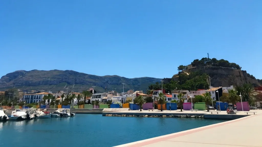
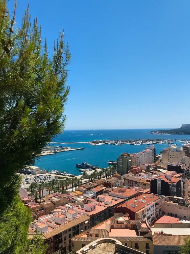
The climb up to the castle winds through the quiet streets of the upper town before opening onto fortified viewpoints shaded by Mediterranean pines. From here, you look down over the red-tiled roofs, the lively marina, and the open sea.
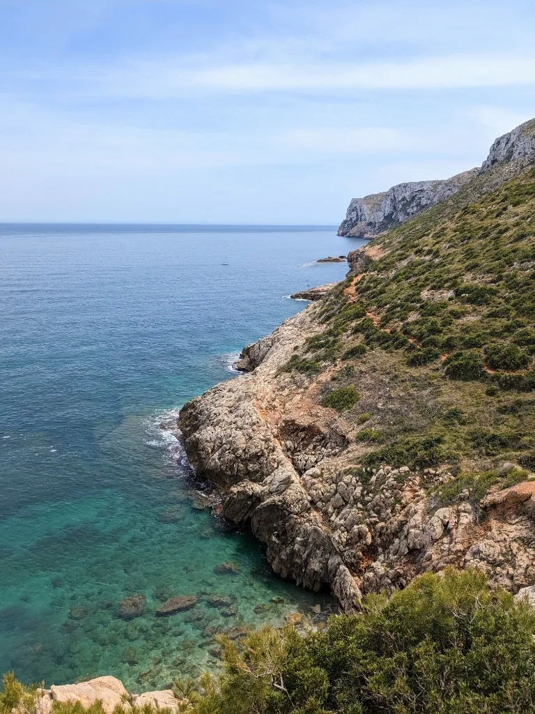
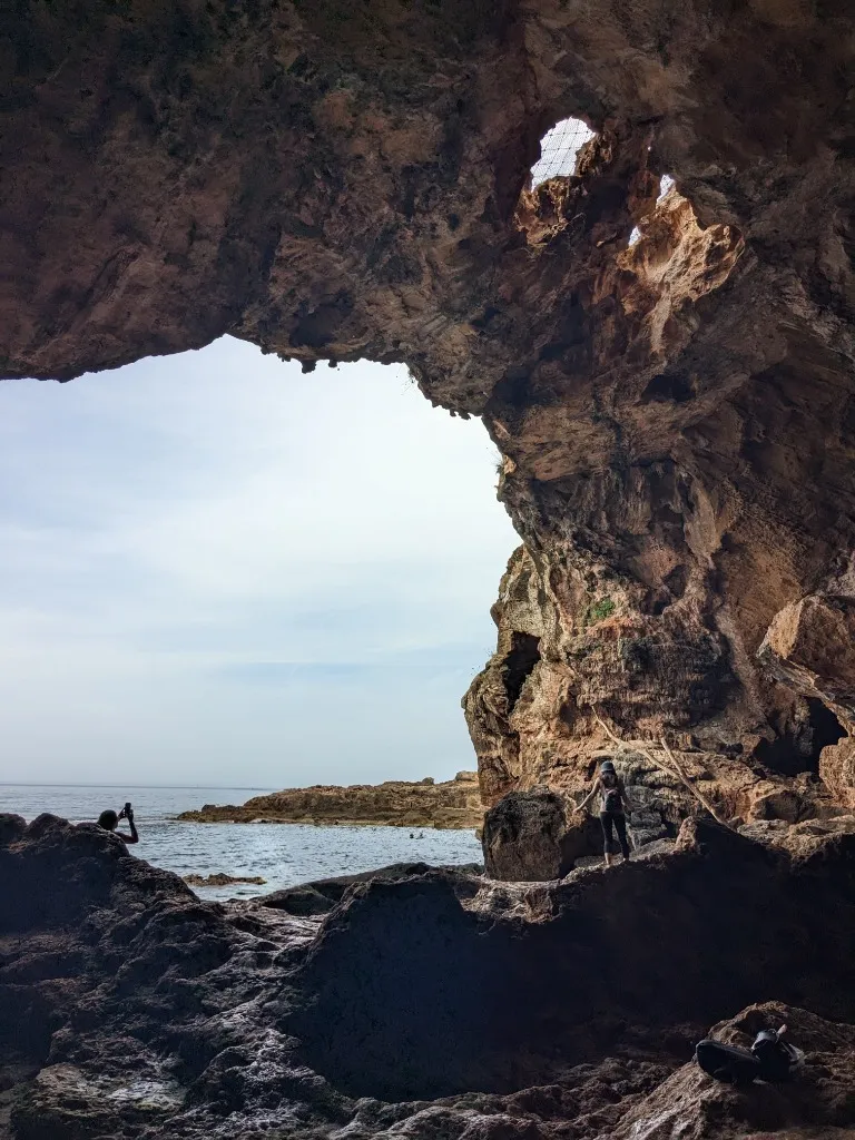
What is my favorite part is the walk to Cova Tallada, an ancient sea cave and quarry carved into coastal cliffs. The views on the way to the cave are extraordinary, but the rocky path has narrow, slippery sections and is not suitable for anyone afraid of heights or unaccustomed to mountain trails. You can walk from Dénia centre to the start of Senda de la Cova Tallada along the coast, but it takes around an hour and a half; the local Les Rotes bus is a shorter car-free option. Check the reservation rules before going.
How to get there
- By car: For exploring the town and castle, park at the port car parks or near the base of the old walls. For Cova Tallada, use designated parking along the Les Rotes road and walk to the trailhead near Carrer Vía Láctea; parking on Vía Láctea itself is prohibited. The final stretch of Les Rotes can have seasonal vehicle restrictions, so check Dénia’s current access and parking advice before driving there.
- By bus: Direct Alsa buses connect Valencia’s central bus station with Dénia, dropping you within walking distance of the port, old town, and castle. To reach the cave trail without a car, take the local bus towards Les Rotes and get off near Carrer Vía Láctea; check the current timetable before setting out.
- Cova Tallada reservation and trail: During busy periods, including summer and Easter, access requires an advance permit through the official Parc Natural del Montgó portal. Check the dates for your visit. From the trailhead, allow about 30 to 40 minutes each way on a medium-to-difficult mountain path with some narrow, slippery sections. Wear sturdy footwear with good grip and bring plenty of water.
Best Seasons: Hiking Trails vs. Swimming Escapes
The Mediterranean climate means day trips are possible year-round, but your experience depends heavily on the season:
- October to May (Hiking, Stone Villages & Castles): The ideal window for active day trips. Inland temperatures hover between 15°C and 22°C with clear skies, making mountain climbs like Mirador del Garbí, canyon walks in Chulilla, and steep fortress ramps in Xàtiva comfortable.
- June to September (Coastal Breezes & Swimming Holes): Inland river canyons become baking hot in midsummer. Save high summer for sunset boat rides in L’Albufera, coastal walks and swimming in Dénia, or dipping into the natural springs of Pou Clar.
- A note on Montanejos: When I visited in June, it felt too crowded for my taste, with tour buses lined up. That’s why I left it out of my main ten. The gorge trails may be more appealing in the cooler months, outside the busiest swimming season.
Practical Planning Tips for Valencia Day Trips
- Village parking etiquette: Ancient villages like Bocairent, Chelva, and Peñíscola have narrow cobblestone alleys designed centuries ago for pack animals. Never try to drive into the historic centers; always leave your vehicle in the designated public car parks outside town.
FAQs
What is the best day trip from Valencia without a car?
Xàtiva is the easiest car-free day trip. Direct Renfe Cercanías C-2 commuter trains run every 30 minutes from Valencia Estació del Nord, reaching Xàtiva in 45 to 50 minutes. For a shorter trip, the municipal EMT bus #24 or #25 reaches El Palmar in L'Albufera in 35 to 40 minutes for €2.00.
Do you need to rent a car for day trips from Valencia?
A rental car is recommended for mountain and canyon destinations like Chulilla, Chelva, Bocairent, Pou Clar, and Sierra Calderona, where public buses are infrequent. However, Xàtiva, Dénia (direct Alsa bus), Benicàssim (Vía Verde del Mar), and L'Albufera can be visited comfortably by direct train or bus.
What is the best time of year for day trips around Valencia?
Autumn through spring (October to May) offers ideal temperatures between 16°C and 22°C for hiking, exploring stone villages, and climbing castle battlements. High summer (July and August) is hot, making swimming at Pou Clar or coastal coves and seaside dining in Dénia better choices than long walks in the sun.
How far are the mountains from Valencia?
The closest range is Sierra Calderona, beginning just 25 to 35 kilometers north of Valencia (a 30 to 40-minute drive). The dramatic limestone canyon gorges of Los Serranos (Chulilla and Chelva) sit 60 to 70 kilometers northwest (about a 50-minute drive northwest).
Read next
More posts for this trip mood
 Europe
Valencian Community, Spain
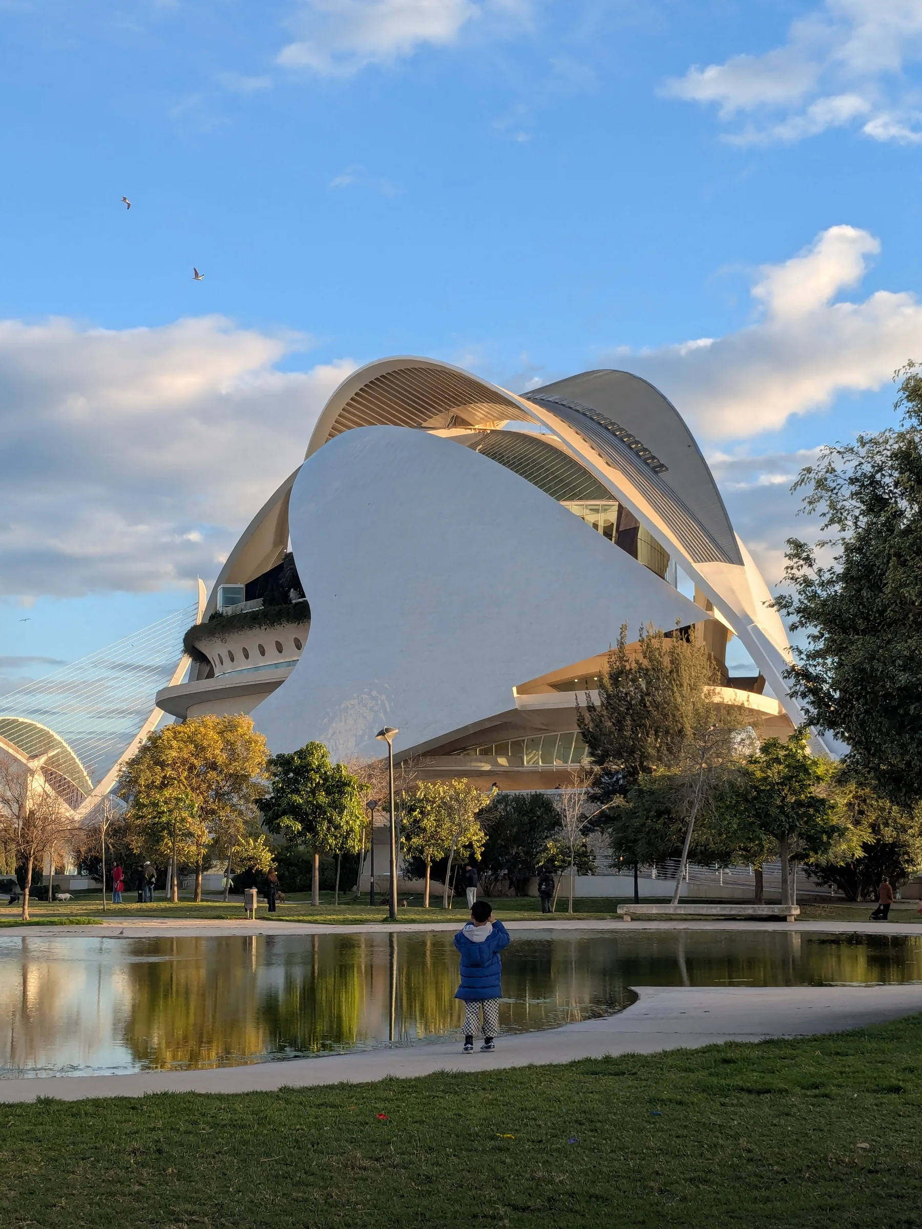
Things to See and Do in Valencia: What's Actually Worth Seeing
A firsthand local guide to Valencia, Spain. From historic El Carmen alleys and biking the Turia riverbed to the City of Arts and Sciences, beach days, and real paella.
 Europe
Valencian Community, Spain
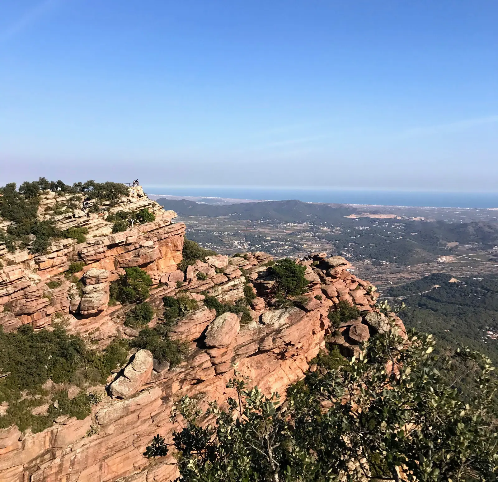
Sierra Calderona: The Best of Valencia's Mountains, From Iberian Ruins to a Dragon
From a dragon-shaped house on a rust-red hillside to Iberian ruins and a mountaintop viewpoint, these are the Sierra Calderona day trips worth leaving Valencia's beach for.
 Europe
Valencian Community, Spain
Puntal dels Llops: The Iberian Fortress Half an Hour from Valencia
Puntal dels Llops is a small Iberian fortress from the fifth century BC, on a hilltop above Olocau.